Day 1 Canton to Tupelo: In Fall 2017, as we were returning from the Chiefland Star Party, we discussed travelling out to the Bortle 1 skies in New Mexico in Spring 2018. As winter progressed, we refined the areas we wanted to visit. Along the way we would get to visit my brother and his family in Amarillo and my sister and her husband in southern Colorado.
The trip would be a combination of camping, AirB&B properties and an astronomy bed and breakfast recommended by another astronomer we had met at the Chiefland Star Party.
We wanted to be in the darkest areas during the new moon when we would have the darkest skies so we backed up from there and determined we would need to leave May 2.
Today we left around 9:30 with Tupelo, MS as our destination. We had loaded our minivan on Sunday, checked and double checked our list of things to take. We left late to miss the worst of the morning traffic from Canton to Atlanta and the plan worked. We really didn't hit anything bad traffic-wise. The drive was uneventful but very scenic. The heavily forested rolling hills of Georgia and eastern Alabama gave way to the relatively flat open fields of north east Mississippi. We arrived in Tupelo around 3:30 and checked in.
|
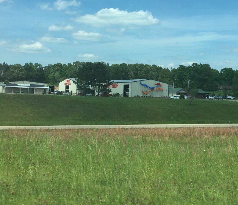
Seen on the side of the road outside of Tupelo, MS
*-*-*
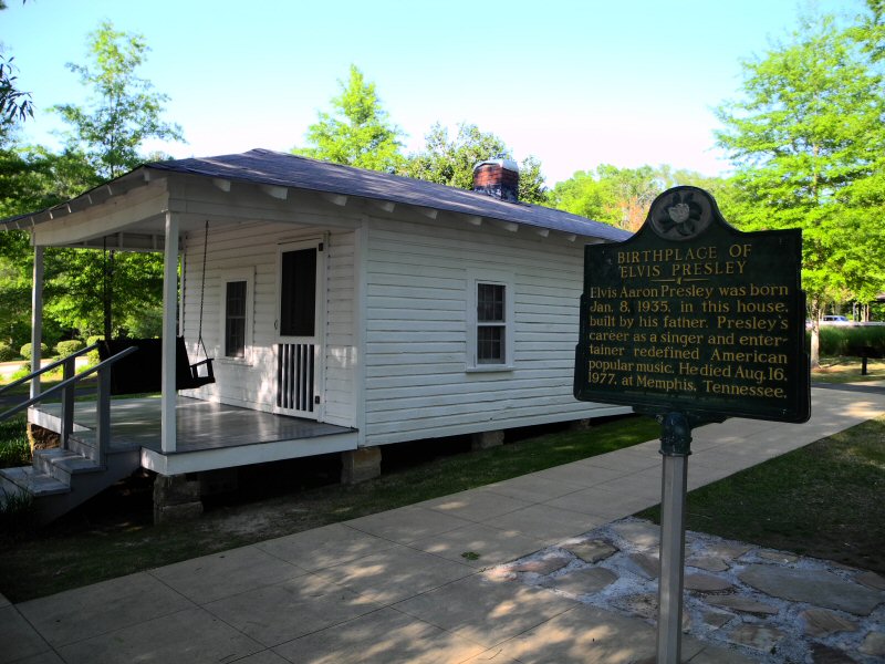
After a short rest we went to see, what else???, the childhood home of the King of Rock and Roll - Elvis Presley. Unfortunately we were too late to get into the museum, but we did get to take a nice stroll around the gardens, saw his very tiny house and the local church he attended as a child. His family moved to Memphis when he was 13.
|
Elvis Presley Birthplace Tupelo, MS
*-*-*
After dinner at a local Red Lobster, we searched a while for post cards to send to a few friends. We have discovered in our travels - no one sells (or apparently sends) post cards any more. There were none of Elvis, but we finally did find one of Mississippi.
Day 2 Tupelo to Conway: The hotel in Tupelo was built in the middle of a large open area rife for development. There were a couple of roads in and out and no traffic, so we were inspired to take a walk before breakfast. The area looked like a former wetlands area which had man-made fill and there were still a few water areas where we saw geese, turtles and a bunny rabbit. After returning to the hotel we had breakfast and got on the road again, this time to Conway, Arkansas.
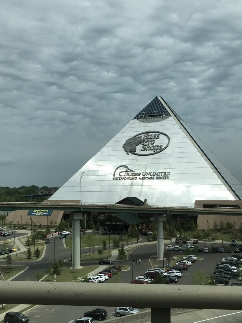
This drive took us through Memphis. It had a very tired and worn look and the area we went through, the southwest corner/downtown area looked like it really needed some economic development. We did pass by the huge FEDEX Memphis hub and saw a number of FEDEX airplanes landing and taking off. That was fun to see. After connecting with I-40 in Memphis we turned west, crossed the mighty Mississippi river and headed to Little Rock.
|
The Bass Pro Pyramid in Memphis, TN just before we crossed the Mississippi River.
*-*-*
The width of the Mississippi and its floodplane is a amazing. The river itself is pretty wide but then it is flanked by wetlands and a floodplane and additional channels. The bridge over it went on for seemingly miles. The eastern part of Arkansas has similar geography to northern Mississippi, flat, open farmland with stands of trees around the edges and along creeks and streams.
We were amazed at the amount of truck traffic along this stretch of I-40. It seemed like we were driving in a long convoy of 18-wheelers and when you would come to a rise or curve in the road it went on forward and behind as far as you could see. This made for a pretty stressful driving day. Then along I-40 the road maintenance crews like to play a game of blocking off one lane of traffic for 10-20 miles and you never actually saw any road construction or there was one small crew working somewhere in the middle of the expanse. It snarled up interstate traffic and dropped the otherwise-70-mph speed limit to 40 (or less). We ran into the worst of that on this day also between Memphis and Little Rock.
Another interesting landmark we passed was the entrance to the Louisiana Purchase National Park near Brinkley, Arkansas. Here is the location of the beginning of all surveys of the newly acquired Louisiana Purchase. This is commemorated by a monument placed in 1926 by the Daughters of the American Revolution when the location of the two sweetgum trees that marked the starting point were rediscovered in 1921 after their location was lost for many years.
We skirted the northeast corner of Little Rock on I-40 and arrived at our hotel in Conway, Ar. We were excited to see an Outback Steakhouse adjacent to the hotel and planned to walk over and eat there for dinner. Shortly after arriving a wild thunderstorm hit with rain coming from all directions and really high winds. It had been overcast all day and the sky darkened as we got to Little Rock. We were relieved that the storm waited until we got to the hotel and we didn't have to drive in it.
After resting in the room for a little bit, we headed out to dinner and to our great disappointment discovered the Outback was closed. We went back to the hotel and the clerk told us they had moved. So we found the new location and headed over there. It turned out to have moved one exit east and was a new design building - very low and southwest looking with open spaces inside and a low-key Aussie design. It was excellent.
Day 3 Conway to Oklahoma City: After a leisurely breakfast at IHOP, we got on the road again. It was going to be I-40 all day today into Oklahoma City, OK. We started climbing into the Ozarks not too far out of Conway and the trees grew more dense and lush with a myriad of different greens. We saw lots of wild flowers - pink, orange and white. Not many trucks today and the drive was very scenic and beautiful. We entered eastern Oklahoma which looked a great deal like Arkansas.
On the way we passed in and out of the lands for the various Native American tribal nations. In reading on Google, western Oklahoma was where many of the tribes which were relocated in the 1800s in what has come to be known as the Trail of Tears. Inititally they had reservations but in the early 1900's when Oklahoma was trying for statehood, they were broken up into non-reservation tribal land holdings with private ownership of land. In each of these areas, the tribal leadership is responsible for laws, governments and courts for the Indian citizens.
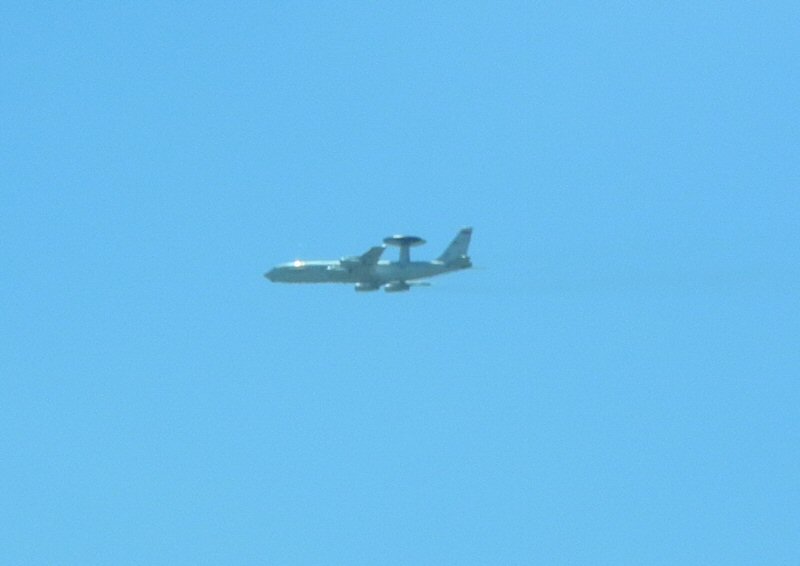
Along I-40 the posted speed limit was 75 mph, which was too fast for us. We typically stayed within 70 mph and traffic was light. Some truck traffic, but nothing like the previous day. The heavier wooded ares gave way to flatter rolling hills with scrubby trees. We arrived in Midwest City/Tinker AFB (west of Oklahoma City proper) and checked in. We were a few miles off the end of the main runways for Tinker AFB.
|
We saw this AWACS plane on our way to the hotel. It was doing "touch and goes" out of Tinker AFB.
*-*-*
We were relaxing in the hotel, trying to decide on a dinner venue when I looked at Trip Advisor and saw there was a minor league ball park in downtown Oklahoma City. Barry quickly determined the team, the OkLAhoma City Dodgers, were in town for a homestand against the Colorado Springs Sky Sox and tickets were available! Ball Park hotdogs for dinner!!
The stadium is located in an area called Bricktown which is the former industrial area. In the 90's they started tearing down the building hulks and developing the area for retail, upscale restaurants, the aquarium and the ballpark. They have done a tremendous job - the area is tourist friendly, walkable with ample parking and lots of stuff happening. We saw no homeless people and did not feel unsafe at any time.
The stadium was accessible, with lots of food choices, dippin dots ice cream and no bad seats!
|
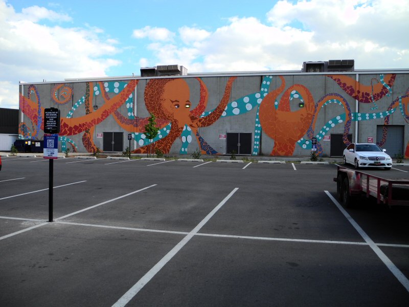
In the parking lot for the stadium was this octopus mural advertising the Oklahoma City Aquarium.
*-*-*

|
Barry and Mickey hanging out together outside of the Chicasaw Bricktown Stadium at a plaza honoring Mickey Mantle (an Oklahoma native).
*-*-*
|
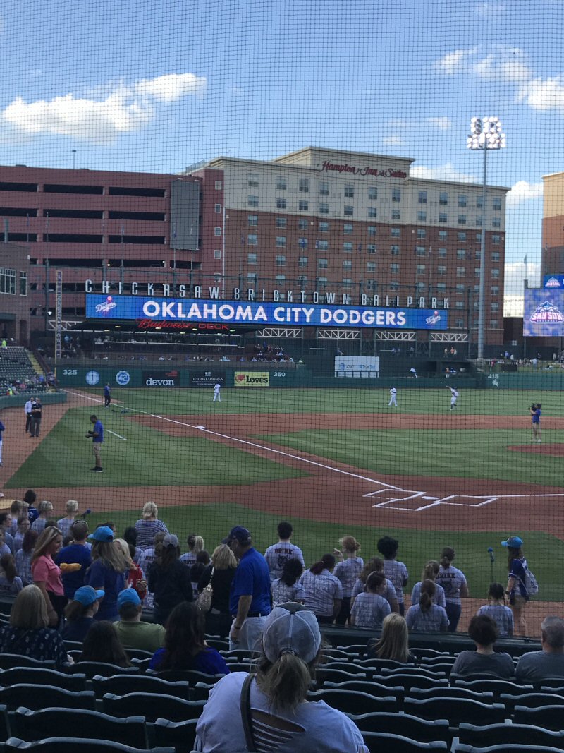
A view of the Chicasaw Bricktown Stadium from our seats behind home plate.
*-*-*
|
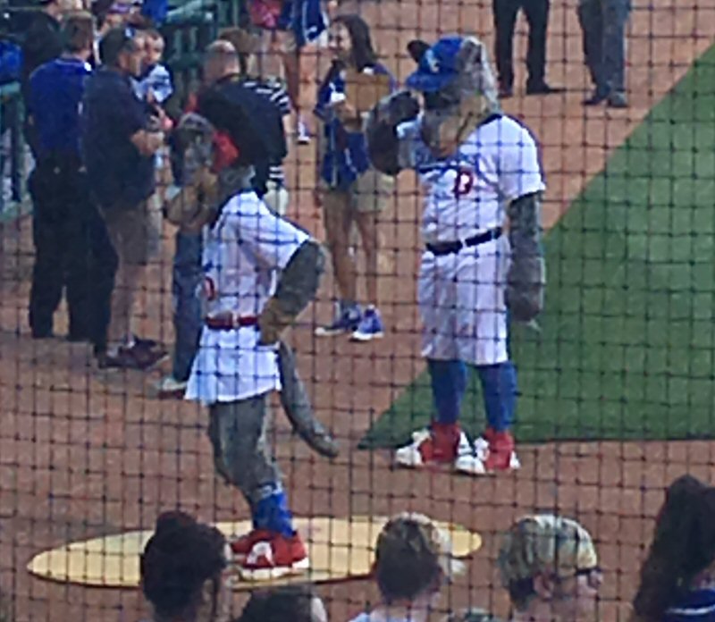
The OkLAhoma City Dodgers mascots - cattledogs: Brix and Brooklyn
*-*-*
|
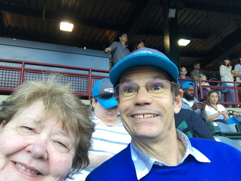
Barry and Lori at the OkLAhoma Dodgers game. The Dodgers won 5 to 1!
*-*-*
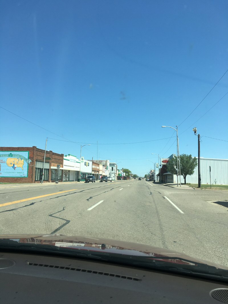
Day 4 Oklahoma City to Amarillo: West of Oklahoma City the terrain was more like the high plains of Amarillo - flatter, dryer and browner. We saw many windfarms which is apparently big business here. Most of the towns and businesses were either closed or barely hanging on. We stopped in Shamrock, a town I remember for the lively St. Patties Day parades in the 70's. Sadly, it looked mostly boarded up. We got into Amarillo mid-afternoon and headed for our motel.
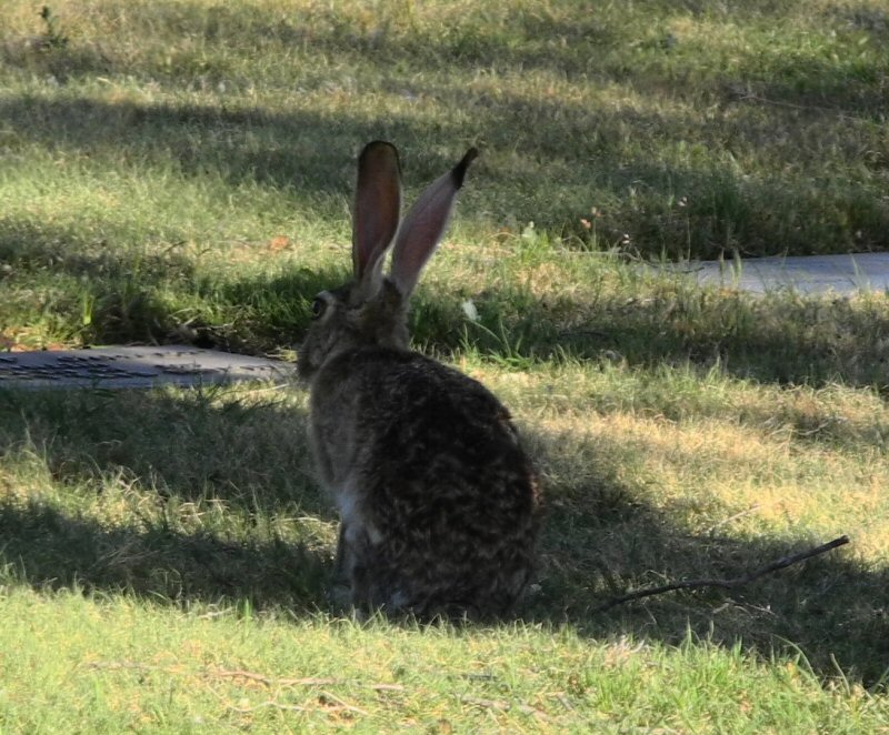
Dinner at the Hobrau Steak house and then off to the cemetery to visit my parents graves. What we found was that a family of jackrabbits lived in the cemetery! They were fun to watch.
The next day was spent in visiting with relatives in the morning and heading to Clayton Lake State Park in the afternoon. We'll pick that up in the next segement.

|
One of the windfarms between Oklahoma City and Amarillo
*-*-*
|
Shamrock, TX
*-*-*
|
One of the jack rabbits at the cemetery. My what big ears you have...
*-*-*