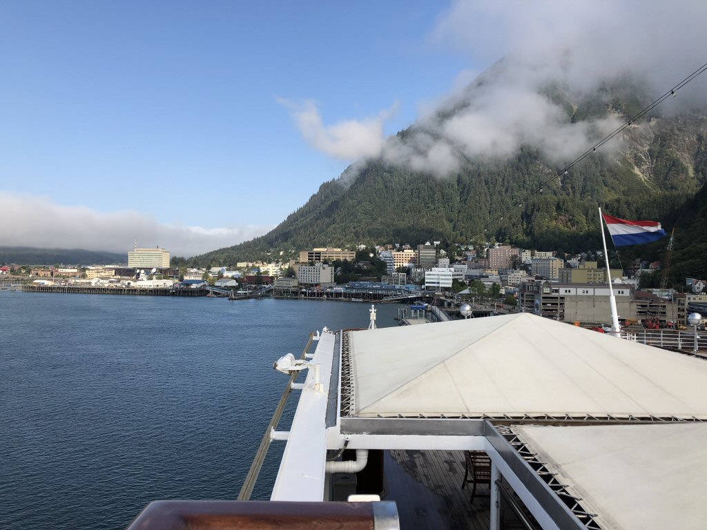
Wednesday August 28th: Juneau, AK The day dawned at 6:30 with very bright sunshine, but it quickly changed into low lying clouds and finally heavy fog as we approached Juneau. Temperature outside was reported as 49 degrees. Today we go on the Whale Watching and Mendenhall Glacier tour.
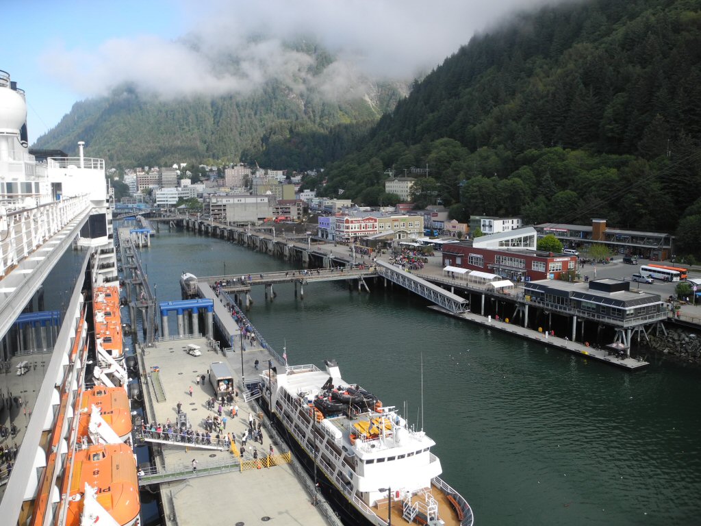
The Juneau Dock area
*-*-*
A view of Downtown Juneau, Capital of Alaska
*-*-*
Our tour left from the end of the dock at 11 am so we left the ship and met up with our tour group. We all loaded on the bus for a short drive to the boat. Our tour guide/ naturalist was a woman named Laurie. She moved to Juneau with her family when she was a small child and has lived here ever since. She was very energetic and full of information. She told us the there were two main roads (other than the town streets) which ran around the area, but both just dead-ended. One was 43 miles long. The other was less. No roads tied Juneau to the rest of the world and most residents liked that. If you wanted to go to the outside world, you flew or took a boat. We have found that the Alaskans who grew up here seemed to really value what they had in terms of the wildlife, forests and mountains and really wanted to preserve it. They also seemed happy in life.
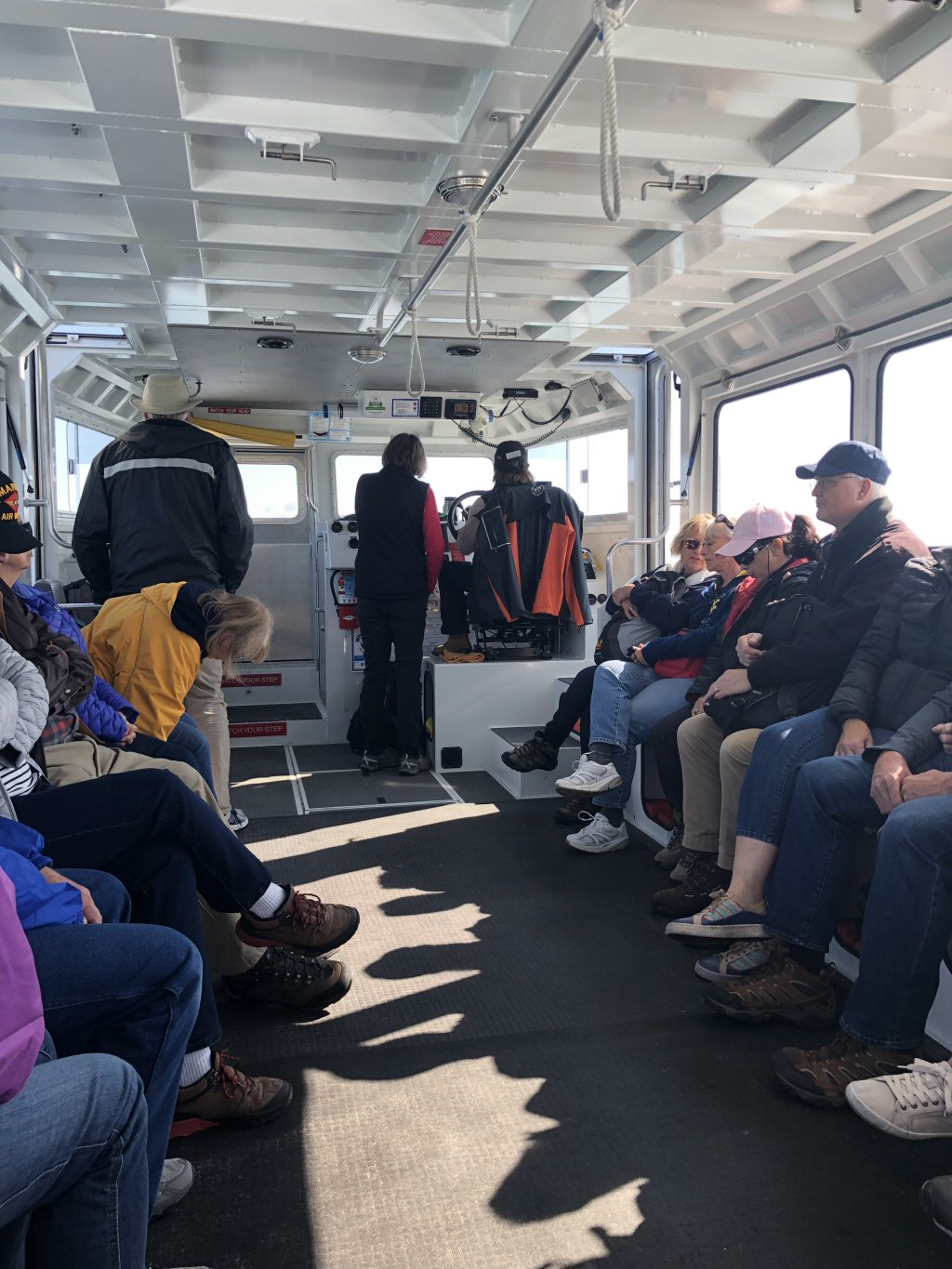
The small harbor where we met Captain Lee. Laurie described him as a cross between Mr. Rogers and Jack Sparrow. We werent sure what to expect, but he turned out to be a very pleasant man who was a very capable captain. I think she nailed the description.
*-*-*
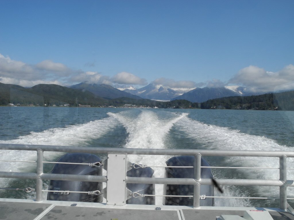
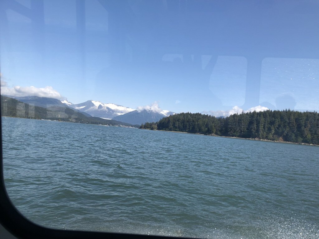
After boarding we headed out to find humpback whales and possibly the elusive Orcas.
*-*-*
Laurie told us the humpbacks were easier to find and more reliable because their favorite food is found in this waterway. They are vegetarian and picky ones at that. They only eat Alaskan plankton and krill which grow in abundance here because of the nutrients provided by glacial melt. The glaciers dump a gray flour-like substance ground off the mountains as they move. It is very rich in minerals that the krill and plankton thrive on.
The Orcas, on the other hand, are typically just passing through and encountering them is more random chance. Orcas are meat eaters and really love harbor seal.
Along the way to the feeding ground Laurie pointed out the various glaciers that are on the mountains surrounding the waterways in the area as well as telling us all about the humpback whales.
*-*-*
She passed around a sample of baleen which is the humpbacks tooth equivalent. They really have no teeth and these serve as strainers to harvest the krill and plankton. The one we saw, taken from a dead whale that washed up on shore, was a smooth plastic-like thin curved blade about 18 inches long, which had fine trailing fibers about as thin a fishing line trailing along one edge. The whale has dozens of these blades in its huge mouth. As it swims along the blades filter out the large items (like fish) and the fingers grab the plankton and krill.
Because they need to eat about 23 hours a day to store enough food and energy to survive the 6000 mile trip to their Hawaii breeding grounds, there are regulations on how much time the whale watchers can observe them and how close they can get to preserve the whales well being. The humpbacks reportedly do not eat on that round trip adventure. And for the females, they may also give birth and nurse their young without eating until they return to Alaska.
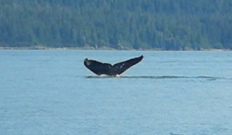
We soon arrived at an area where there were a number of other boats and quickly saw the spouts of several whales in different areas followed by their heads and backs. There were definitely a group of humpbacks in the area and everywhere you looked youd see another spout! It was very exciting.
A humpback just submerging
*-*-*
Whales in Juneau, AK
*-*-*
But soon, Laurie said there was a report of Orcas and we were off to see if we could see them. Here is where Captain Lee was in his element. After a full speed run for about 15 minutes further down the channel, we came to a small rocky island which was home to a number of sea lions. On the backside were the reports of Orcas. As we rounded the island we saw the telltale dorsal fin of a male Orca. Captain Lee maneuvered the boat to parallel the path of the orca and we watched the orca for about 15 minutes. He would blow, surface, then submerge and then come up again some distance away. Everyone on the boat was excited. We got to see not only humpbacks but an orca! Unfortunately he did not like to have his photo taken.
Soon it was time to go and we circled to the front of the tiny rocky island to get photos of the Steller sea lions. These sea lions are larger and more aggressive than their California cousins. They also had a very loud bark.
*-*-*
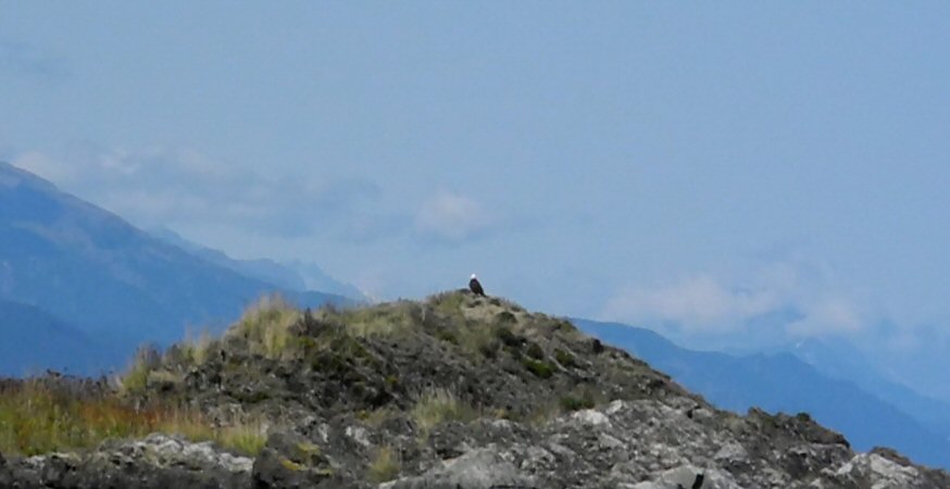
Also on the island on a little hill sat a bald eagle. What a majestic sight!
*-*-*
We had gotten partway back to the dock when along the shore, the captain spotted another humpback and we moved in for a closer look. It blew and surfaced a couple of times before dipping under the water and moving away. And we turned once more to head into dock. As we came close to our dock, someone spotted a harbor seal swimming about popping his head above the water to watch us. A perfect ending to a great whale watching tour!
Laurie and Captain Lee on-board our whale watching boat
*-*-*
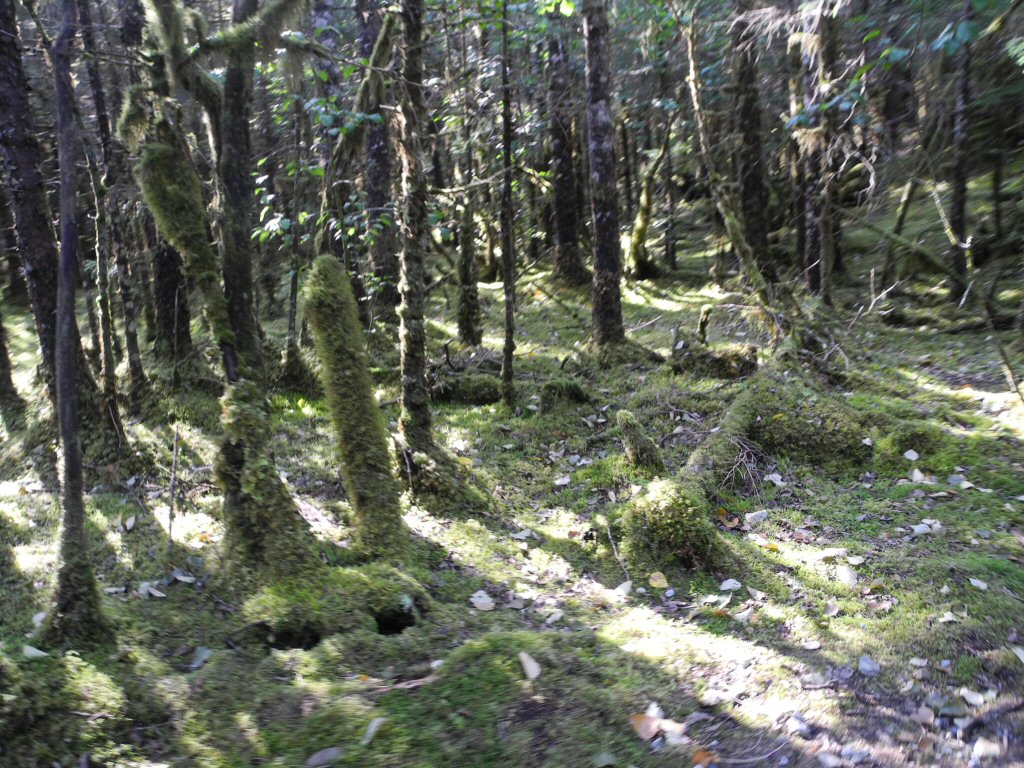
After leaving the boat we boarded a new bus and headed for the Mendenhall glacier. This is a 13 mile long glacier near Juneau. It is viewed from Mendenhall Lake at the western edge of the glacier. A short hike through a lovely heavily treed forest takes you to the lake.
The forest is unlike any we had been in. What made it unusual is that everything, floor, trees, and rocks is covered in various mosses. The is a temperate rainforest area meaning it is close to an ocean on mountainous terrain facing the ocean. Typically there will be at least 40 inches of precipitation which falls evenly year around and temperatures are a moderate 40 to 70 degrees F. There is a luxurious tree canopy that blocks at least 70% of the sky at ground level and most of the trees are coniferous, in this case Sitka spruce and western hemlock.
*-*-*
This are is also known to harbor black bears who congregate around the Mendenhall River. This river provides a veritable salmon buffet this time of year. Laurie said the sockeye were spawning now and shortly the Coho would spawn. As we walked everyone was alert at the hope/fear of seeing a bear. There was an area roped off nearest the river to keep humans out. No bears were spotted and soon the trail opened on the lovely Mendenhall lake.
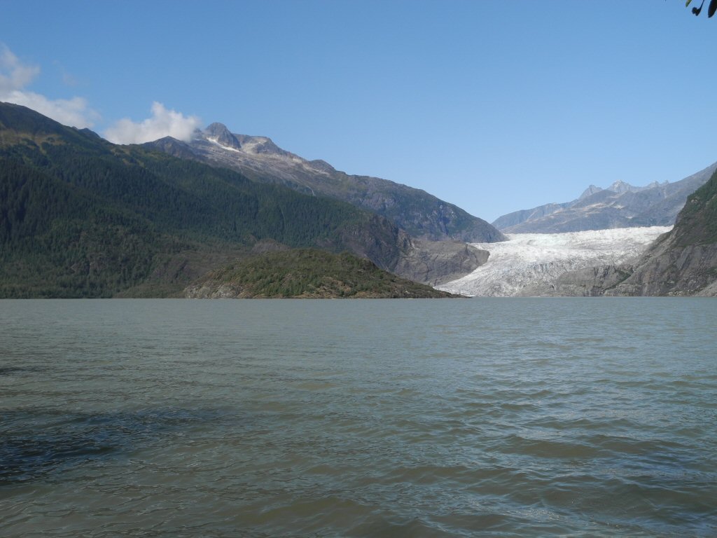
A view of the Mendenhall Glacier and the glacier-fed Mendenhall Lake
*-*-*
Laurie had a series of pictures taken of her family at this very spot since 1955 when she was 3 months old. It showed the dramatic recession of the glacier over the 60 or so years. The pictures started before there was a waterfall, the lake was much smaller and the thick glacier ice was a deep blue and no rocks are visible. The pictures show the formation of the waterfall, the baring of the large rocks and the growth of the lake. Laurie said the locals estimate that by 2030, the glacier may no longer be visible from the lake.
After ample time for photo ops, we headed back through the woods to the bus. We went through the bear preserve portion (this guide group has permission to take small groups through). It smelled very pungent with the odor of decaying fish. We saw signs of beaver - trees cut down with the knife-sharpened pencil look and bear scat which was being picked through by birds.
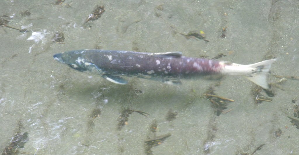
Then we crossed the Mendenhall River and saw the sockeye salmon. When they get to spawning age they turn a really strange reddish color with green lips. It almost looked cartoon like.
*-*-*
Then we boarded the bus and headed back to the ship. It was a great shore excursion and Laurie was an excellent guide!
Back on board we rested until dinner and then ate in the dining room. It was empty due to some really long shore excursions and part of the guests opting to eat in Juneau since this was a late departure of 9:30. We were all tired so we decided to spend a quiet evening in the room. On our way back we ran into our favorite photographer, Basundhara, and visited with her for a while. It was a very pleasant reunion!
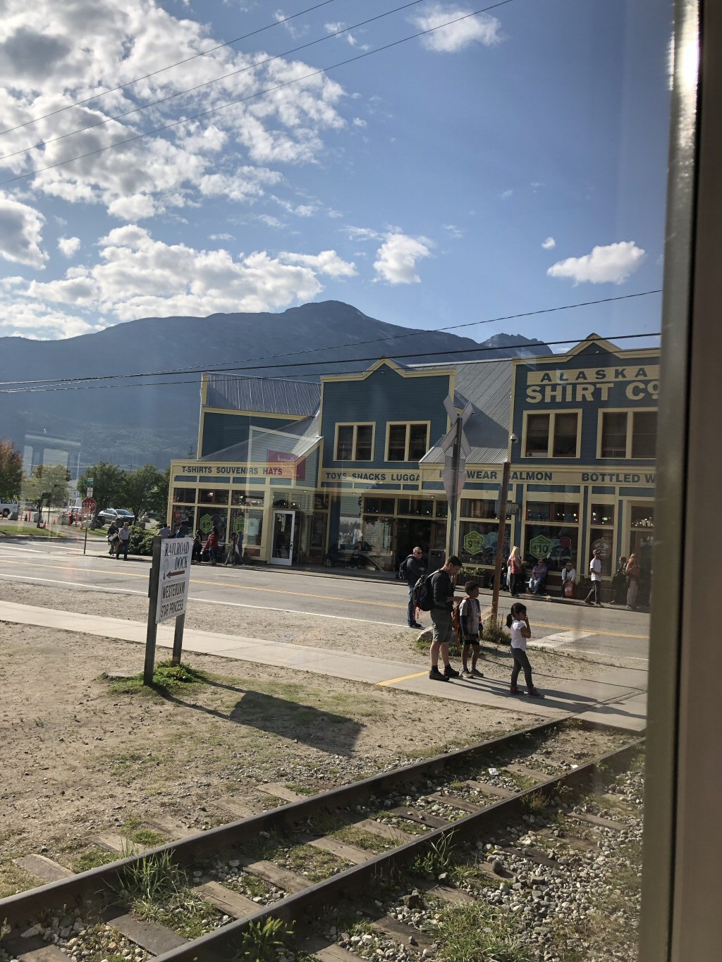
Thursday August 29th: Skagway, AK : Because our excursion didnt leave until 1 pm, we had the morning to relax and we took full advantage of it by waking up a little later than usual, taking some photos of the port from our ship and lazily catching up on news. Unfortunately Barry caught a head cold and didnt feel like going on the shore excursion so Kevin and I would have to go it alone.
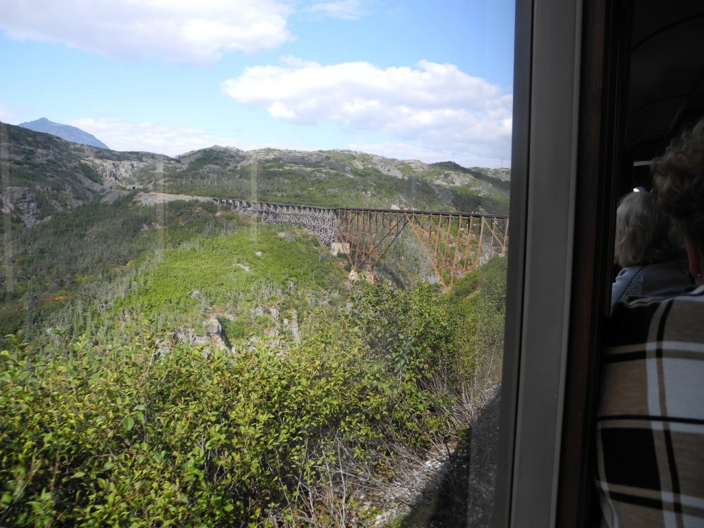
We boarded the White Pass Summit rail road train at 1 pm and left shortly thereafter. The train was not completely full so we could spread out a bit in our car. There was centralized narration on our 8 car train and roving guides. Car 1 was non-cruise-ship passengers, cars 2-4 were other passengers from our ship and cars 5-8 were passengers from a Princess ship also in port.
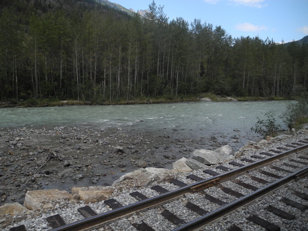
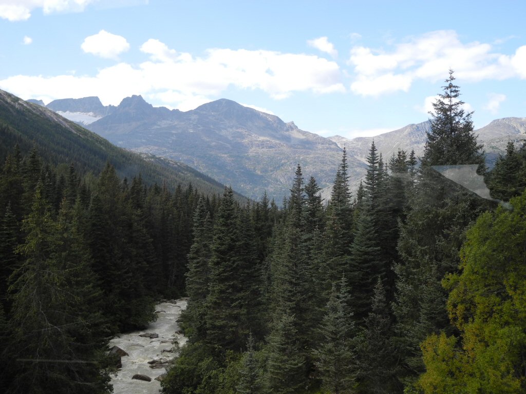
The tracks running alonside the Yukon River
*-*-*
As you leave Skagway, for a short while the train is on fairly level land surrounded by trees. Soon the land on the left side of the train falls away as you climb out of the valley. In some places it is barely wide enough for the single set of train tracks. Thankfully there are trees on most of this very steep slope to obscure the steepness, but occasionally the trees open up and you are looking into an abyss. It takes your breath away and sends a tingle up the back your head. It is unbelievably beautiful but also terrifying as you can imagine plunging over the edge and into the celadon green Yukon River a thousand feet below.
The train tracks we were riding on were built in 1898 in 26 months by a grand total of 35000 men. Many came to Alaska for the gold rush, failed to even get to the gold fields because of harsh conditions and worked only to make enough money to get back home. Only 35 people died in spite of the dangerous conditions of blasting a ledge on the side of a mountain and drilling using steam powered drills. They made 30 cents an hour or $3.00 a day. No matter the season, they camped in the valley and had an almost vertical climb to the job site. The average length of employment was 2-4 weeks.
The train was built to get the miners the 45 miles up the 3000 ft change in elevation to Lake Bennett where they could then float 555 miles down the Yukon to the goldfields. This route replaced the White Pass trail. The White Pass trail was the better of the two pack routes to the gold fields but was still a very steep narrow trail traversed in both directions by man and horse to accumulate the necessary 2000 lbs of provisions required by the Canadian government to cross into Canada and head for the gold fields. This was believed to be the amount of food necessary to survive a year in the wilderness. It is estimated that 3000 horses died on this trail.
The White Pass line is a narrow gage train with rails 36 inches apart. The entire width of the roadbed is only 10 feet wide. That means there is only 3.5 feet outside the rail on either side! Yikes. The steepest grade is almost 4%.
The mountains on either side are spectacular. Most of them have rounded granite tops with tortured sides that show evidence of the glacial activity that shaped them. When the trees open and the river can be seen below it is boiling and rushing to meet the sea. It is colored by the glacial flour to a creamy pale green and it is magnificent.
*-*-*
A view of a glacier we passed (upper left) with the river in the foreground.
*-*-*
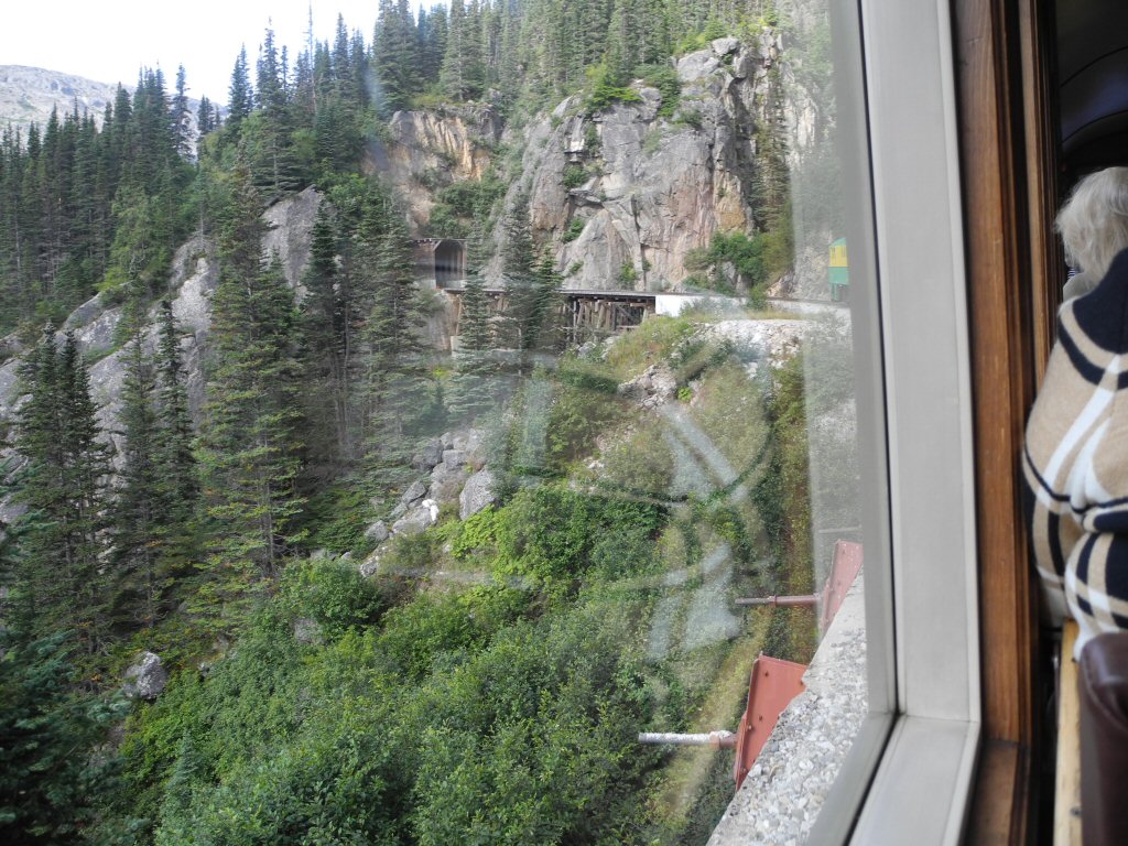
As the engine climbs, you can see glimpse other passenger trains ahead crossing the high trestle bridges or disappearing into the tunnels.
Soon our train arrives at the first trestle bridge across Glacier Gorge that leads into the first tunnel. The tunnel only lasts 30 seconds but it is in absolute darkness. Just as we exit and look out the left side window we can see all the way down the valley to Skagway Harbor and glimpse our cruise ship in the distance.
*-*-*
The river in the valley below.
*-*-*
We continue climbing and a black bear sighting is announced out the left window. We all scurry to look. Some are lucky enough to snap a photo. We continue on to the black cross monument. When blasting the granite on a portion of the mountain, a 500 ton piece fell and crushed two workers and their pack horses. Their coworkers couldnt move the fallen piece to recover the bodies, so they placed a simple black cross on top marking the spot.
The next landmark is the no-longer-used Steel Cantilever bridge which a trestle / iron bridge that is just gorgeous. It was built in 1901 and is 215 feet tall. At the time that was the tallest railroad bridge of its kind. It was retired in 1969 and portions of the trestle have started to crumble. It is still amazing. I am glad the train no longer crosses it, but as you look at it you wonder how it was even built. While the new bridge is comforting it is not as scenic.
*-*-*
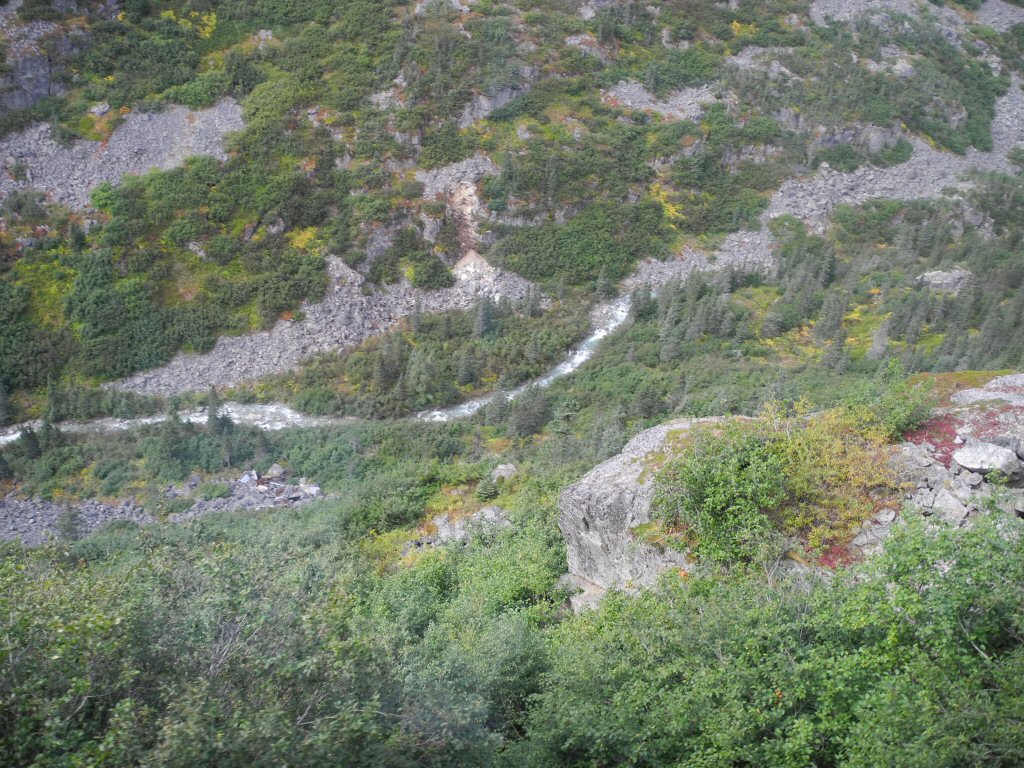
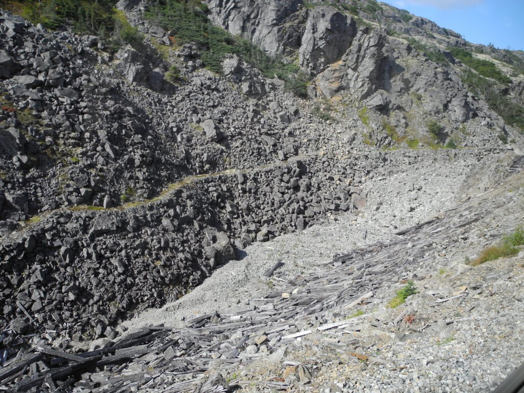
Beyond the bridge, views of Dead Horse Gulch and the original White Pass Trail show the challenges the men and horses faced before the railroad was built. It is hard to imagine hiking the narrow trail much less with a loaded pack animal and heavy back pack.The trail is the very narrow ribbon of green about 1/2 the way up the photo running left to right.
*-*-*
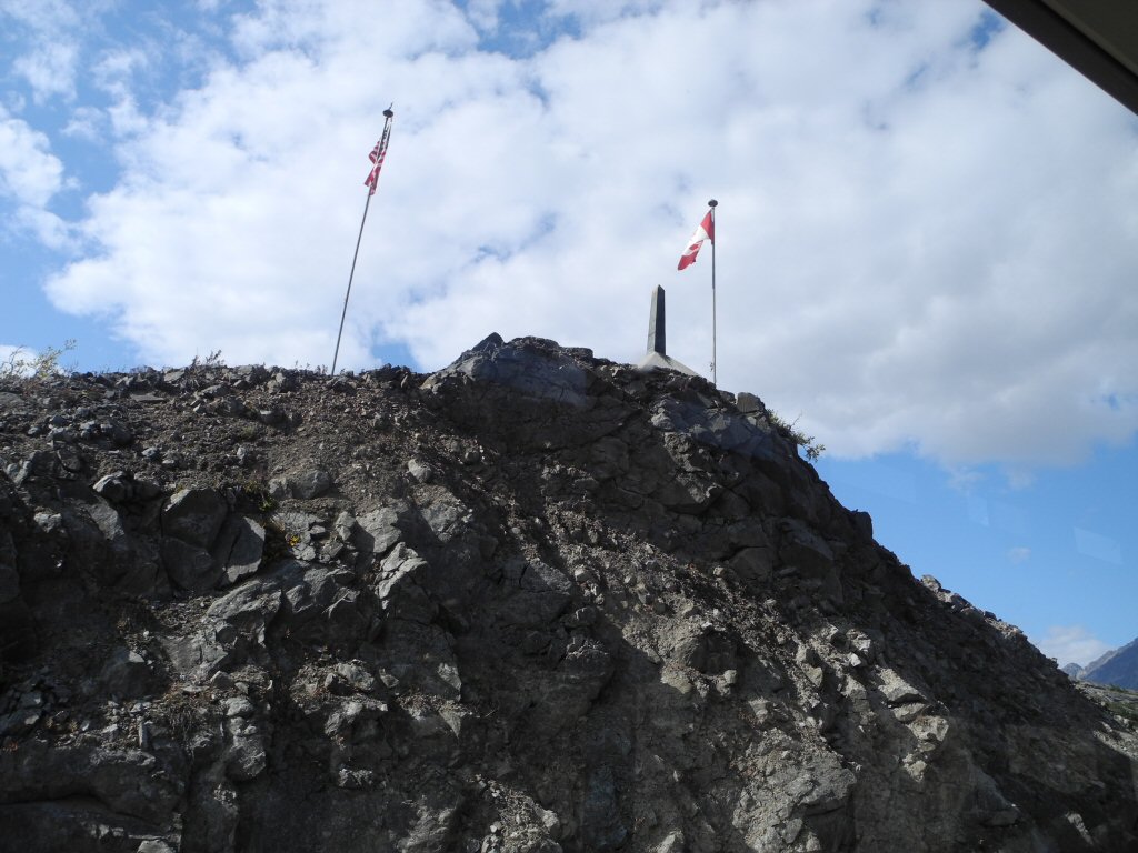
Crossing the Canadian Border. Both U.S. and Canadian customs are located miles away.
*-*-*
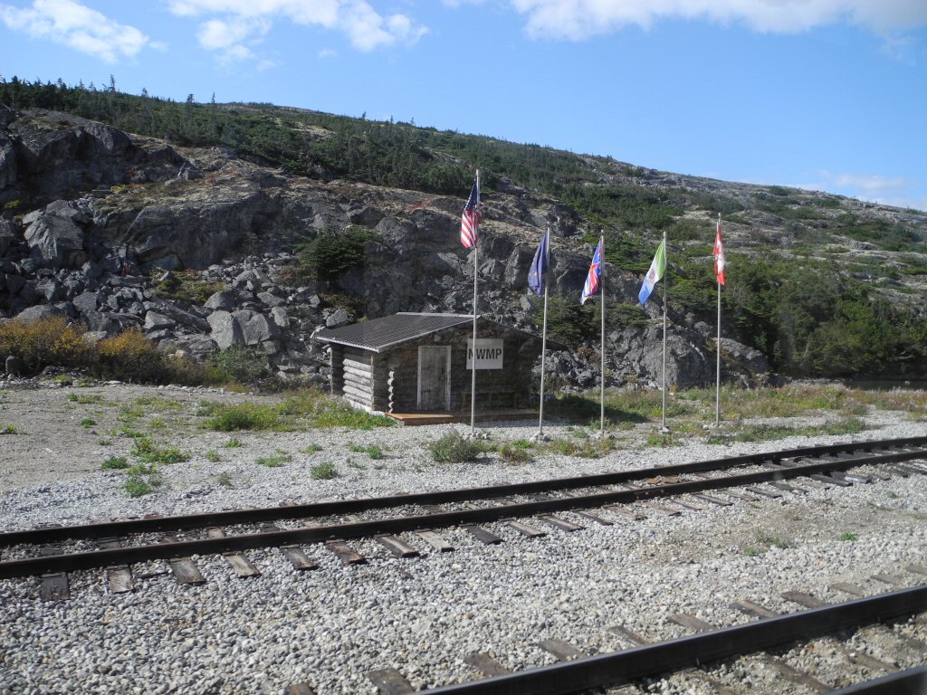
A replica of the Royal Canadian Mounted Police cabin which served as the entry point for the miners sits beside the track just beyond the border. It was here they had to produce their 2000 pounds of supplies.
*-*-*
Then the the train passes Summit Lake, headwater for the Yukon River. It then does a loop and returns down the mountain the way it came.
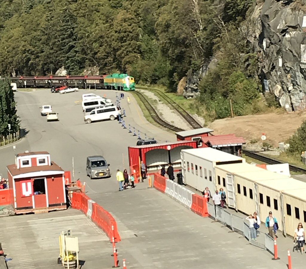
We arrive back in Skagway and the first stop is the train depot. Interestingly when the train stops in downtown Skagway to let off passengers, it blocks the main street through town holding up traffic and pedestrians for the 10 minutes of the stop.
*-*-*
The train backs up and heads down to the dock and takes us back to the ship. Barry catches a photo of our train approaching the dock area.
*-*-*
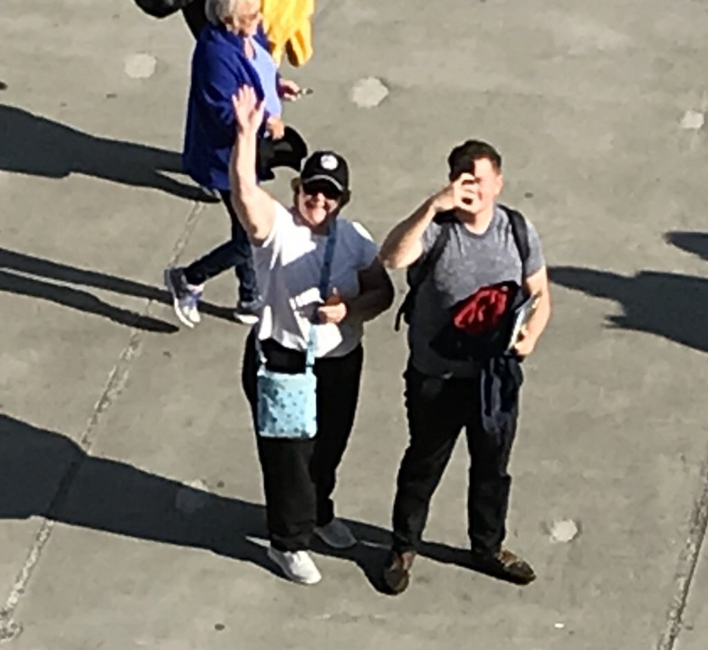
We arrive back at the ship. Lori is traveling incognito wearing a ball cap purchased for Barry's brother Dale - a huge train fan.
*-*-*
After dinner, we headed for the Main Stage to see illusionist James Cielen. He was very entertaining and had some interesting illusions like making two Pomeranian dogs appear (and disappear) at versions times during the show. We thoroughly enjoyed his act!
Then it was bedtime because at 6:15 tomorrow we enter Glacier Bay and we want to be up for that!
Friday August 30 Glacier Bay National Park:We awoke early with the anticipation of cruising the very scenic Glacier Bay In Glacier Bay National Park. We headed up to the Crows Nest and we rewarded with a misty panorama of scattered islands with low mountains as we threaded our way into Glacier Bay. The bay, an elongated waterway, was formed by the receding of glaciers within the last 150 years.
The misty entrance into GlacierBay
*-*-*
As we passed the park ranger station at the entrance to the bay, a zodiac inflatable boat came alongside and without stopping transferred 3 park rangers aboard to provide narration for our journey. As the two vessels matched speed, the rangers clambered up a rope ladder.
The speed of the ship was very slow to prevent a wake and any damage to wildlife or shoreline. Early in the day there were some sea otters playing in groups in the water. They would lie on their backs and float and then plop over and duck under water then pop up somewhere else. Very cute little creatures.
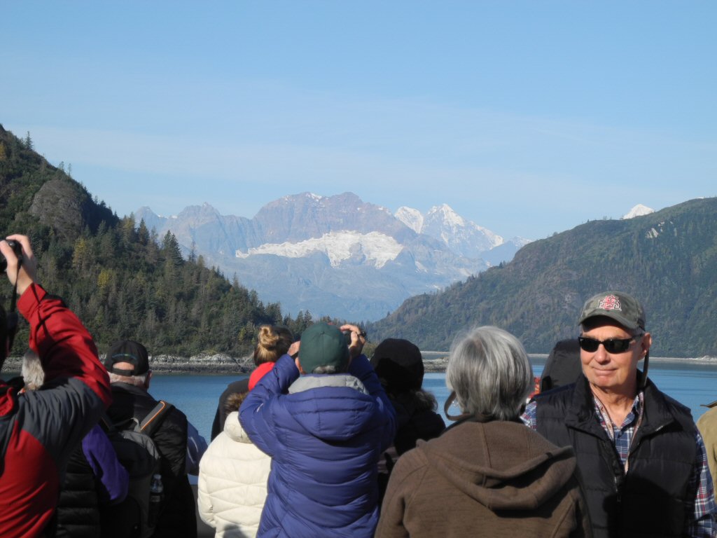
As we crept further into the bay, the sun broke out and it was a very pleasant temperature and a beautiful day. They opened access to the bow of the ship and all the forward decks and people were outside enjoying the beautiful views and the weather.
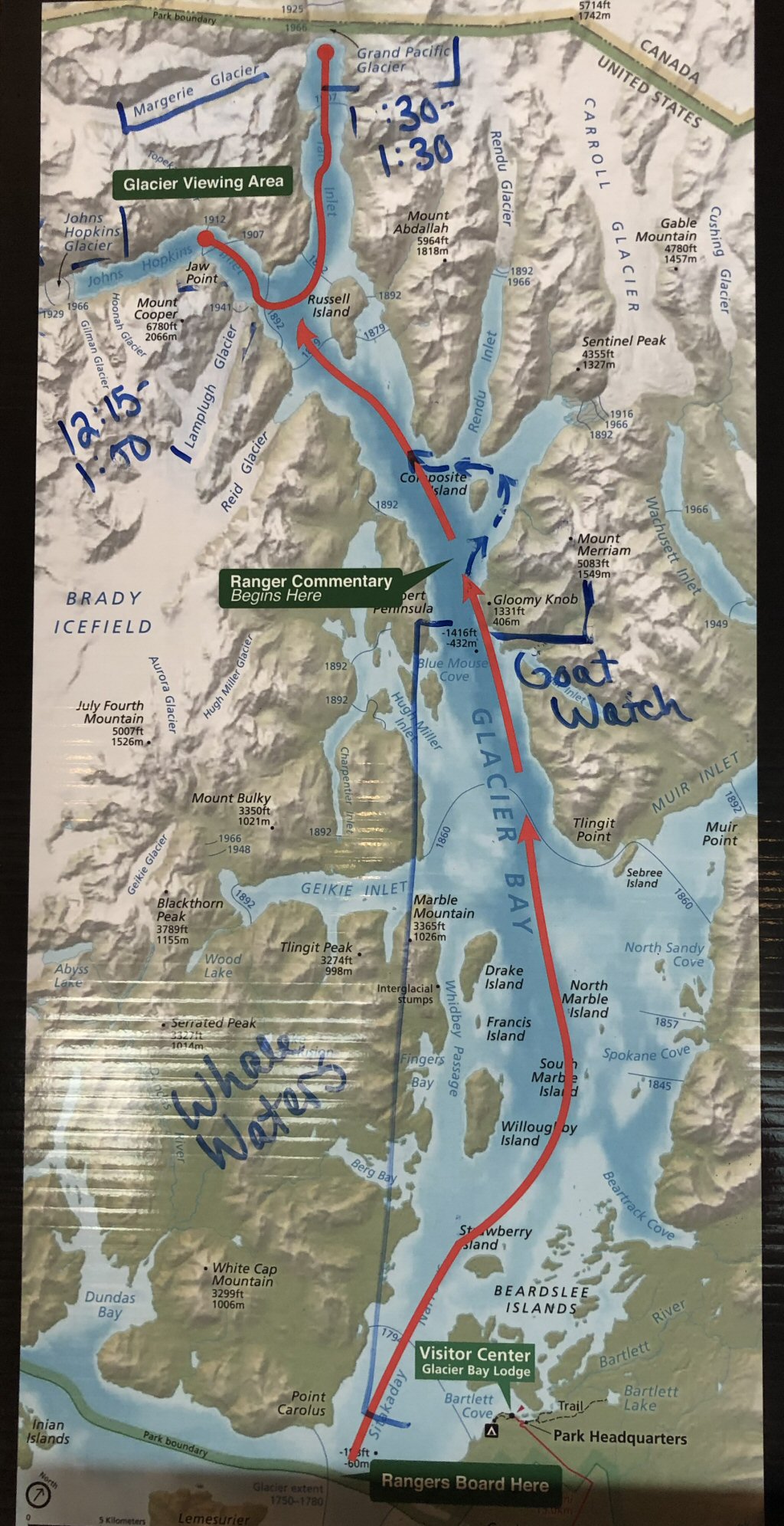
This is a map of Glacier Bay and the path the ship was to take on our journey
*-*-*
In the distance you would catch glimpses of snow covered peaks and glacial areas.
*-*-*
A glacier can bee seen straight ahead. This is part of the Brady Icefield.
*-*-*
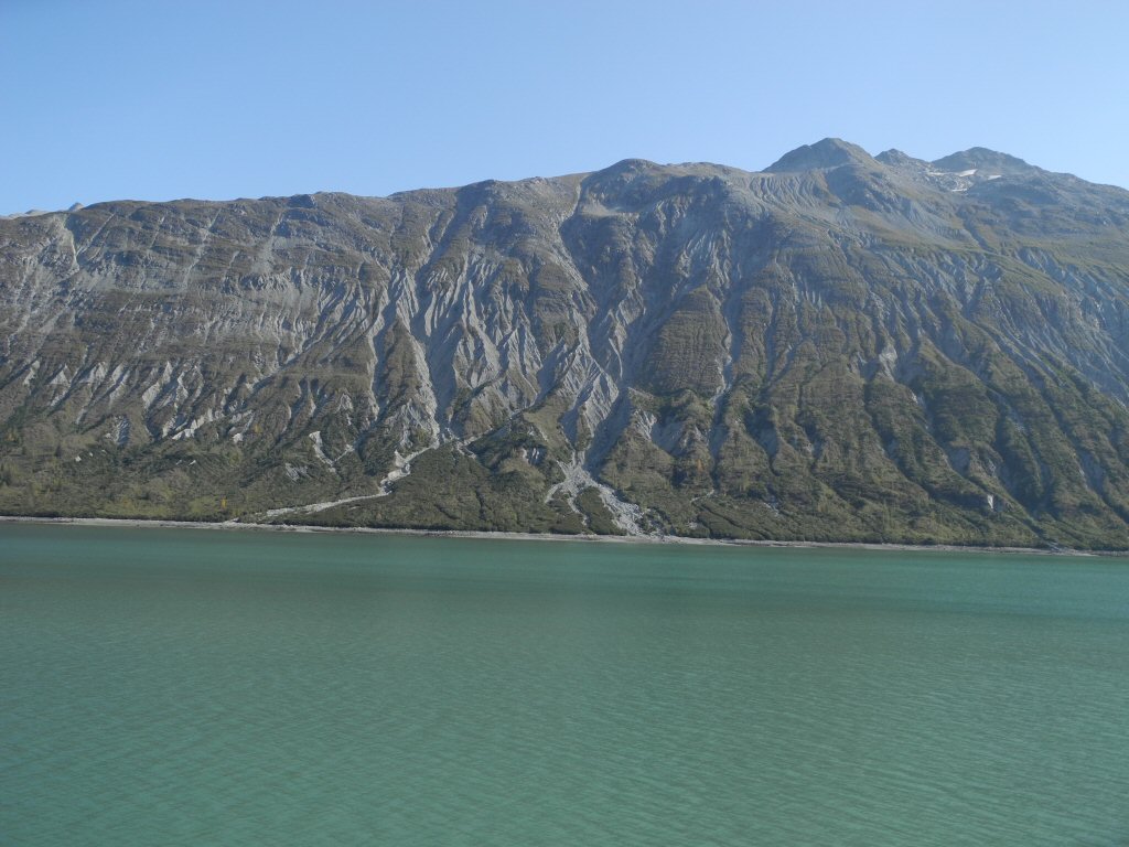
Up close you would see the wholesale scarring of the land from the glacial activity - deep scoring like some giant beast had scraped his claws down the rocks and fields of debris which looked like gravel but each piece was the size of a refrigerator.
*-*-*
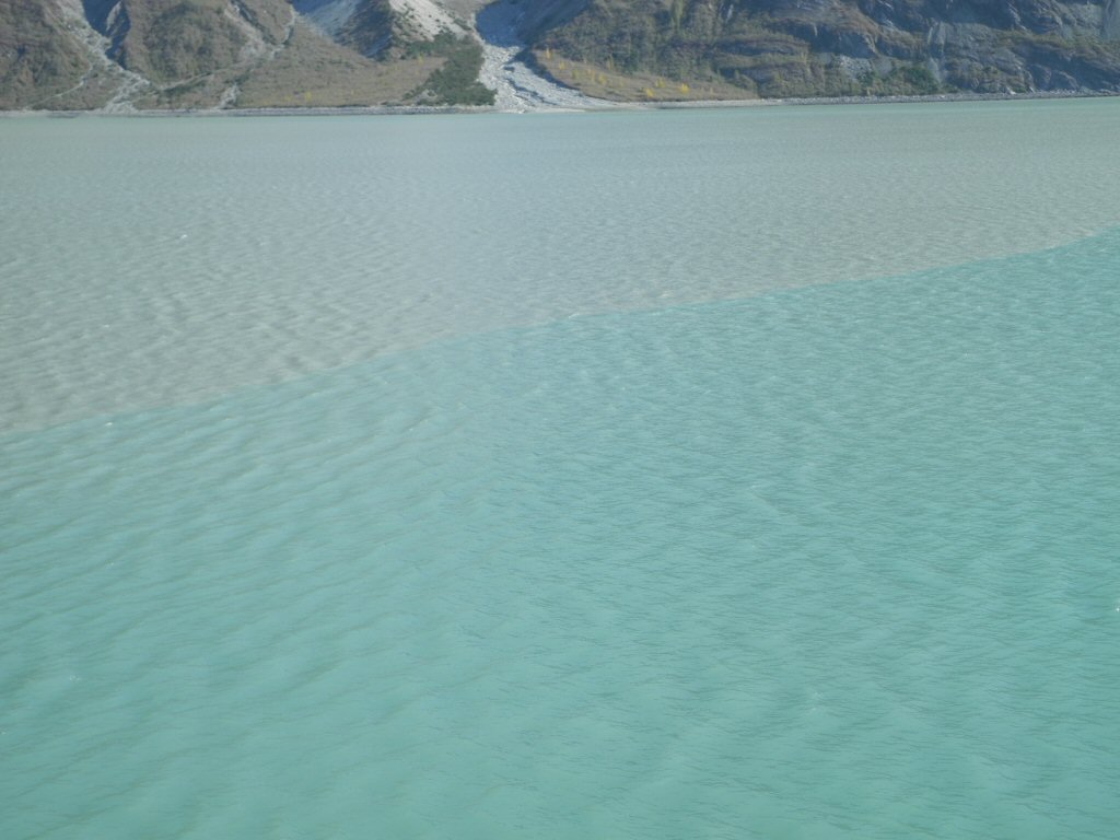
In the water, near the shore, the telltale gray-green milky coloring of the granite flour where glacial melt meets the bay.
*-*-*
There were a few sightings of humpback whales, many sightings of sea otter and lots and lots of sea birds. Sea gulls followed the ship all day and were mesmerizing to watch, swooping and diving and then gliding right along the length of the ship as if watching the passengers as much as the passengers were watching them.
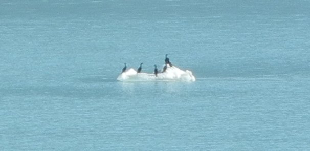
Here some sea birds rest on an ice chunk floating in the water.
*-*-*
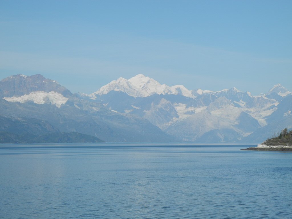
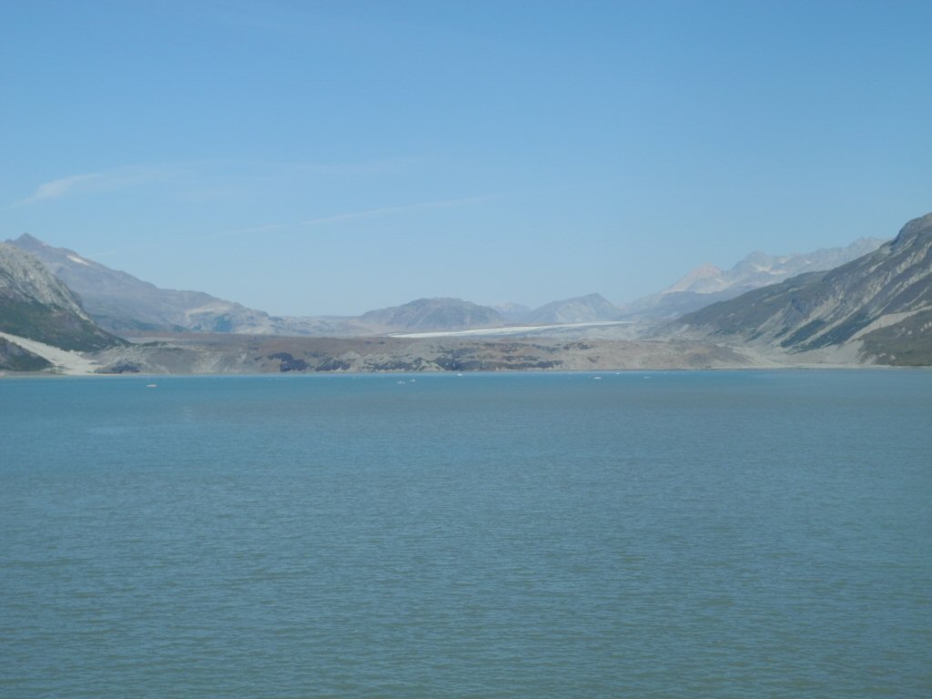
We finally reached Tarr inlet where we looked at the Grand Pacific Glacier and the Margerie Glacier. The Grand Pacific Glacier is no longer visible from the bay. It was once the largest and most visible glacier in the area but all that is left at the edge of the water is a rubble strewn area of ground up rock and smooth granite outcroppings. Further in the distance a small layer of white peeks out. On maps we were given, this glacier extended all the way to the entrance of Glacier Bay in 1780.Most of the receding and the formation of glacier bay was done prior to 1880.
*-*-*
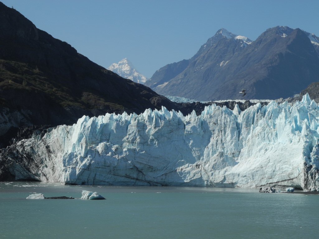
Margerie Glacier is a wall of ice that comes down to the ocean. It has the characteristic deep blue veins along with several veins of ground up granite. We cruised this area for a while allowing the ships passengers to take in the splendor of the glacier.
*-*-*
As we did a slow turn, the sea gulls flew lazily about. Occasionally they would land in the water and ride the currents created by the giant azipod propellers.
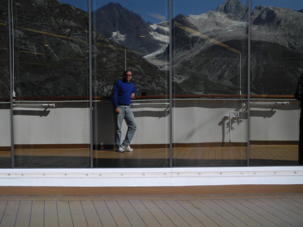
We then turned and headed out of the inlet and into the adjacent Johns Hopkins inlet to see the eponymous glacier. We stop facing a side of the Margerie Glacier and the Topeka Glacier. Here Barry takes a self-portrait using the plate glass windows of the Ship's gym to reflect the Topeka Glacier.
*-*-*
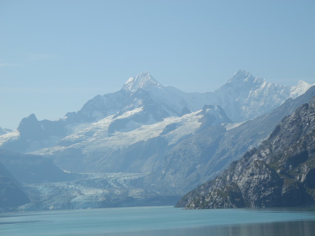
The Johns Hopkins Glacier.
*-*-*
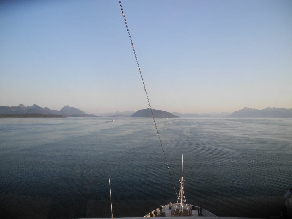
We turned and made a slow exit out of Glacier Bay. Our National Park Rangers left the boat, and we left Glacier Bay and started our last leg of the cruise along the Gulf of Alaska to Seward. For the first time we leave the protected waters and feel the ship reacting to the larger ocean, although it never gets really rough.
Saturday August 31 Cruising to Seward:The morning started around 5:45 when there was announcement on the Public Address system about a medical emergency in one of the cabins aboard. We went back to sleep and woke up later for breakfast and to attend the disembarkation lecture.
About 9 AM the Captain came on the PA to announce that a helicopter evacuation of a medical patient would occur in around 45 minutes and all outside decks and balconies are closed to all passengers until further notice. Having been to all of the decks, we wondered where a helicopter would land as none of them were big enough. Then, out of our Veranda window, we saw the helicopter which swung near the ship and out to sea several times. Kevin, who was in the Lido cafeteria, said it didnt land. It hovered and they lowered and lifted a basket stretcher before flying away from the ship. A little later the Captain announced that the evacuation was successful and all decks were open again.