Monday September 9 Fairbanks to Tok, AK:We slept late again because we were up aurora watching until 1:30 A.M., ate breakfast, did our final pack and bid our hosts good bye. We got on the road for the 4 hour drive to Tok in eastern Alaska along the Alaska Highway - Alaska 1.
It was a beautiful drive, mostly on flat terrain bracketed by spruce, aspen and birch trees. Many of the trees are dropping their leaves as autumn is very short here. Another week and we probably wouldnt have been able to enjoy the colors.
After leaving Fairbanks, we passed by the town of North Pole, AK. We didnt stop here but this town, starting in the 1950s, made a practice of collecting letters from children to Santa and responding back by mail. A team of volunteers made sure every letter was answered. There is also a huge year-around Christmas shop.
|
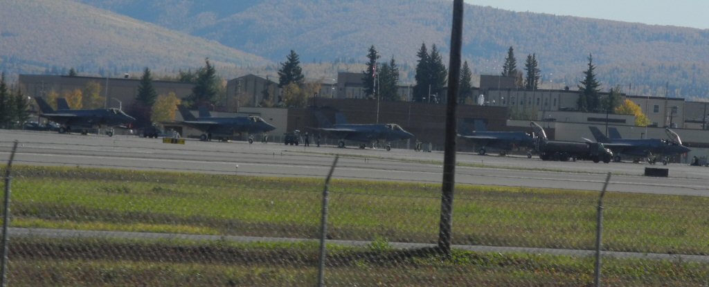
We passed through Eielson Air Force base which boasts the second longest runway in North America. It is home to KC-135s and Red Flag, Alaska. We also saw these F-35's sitting on the runway!
*-*-*
|
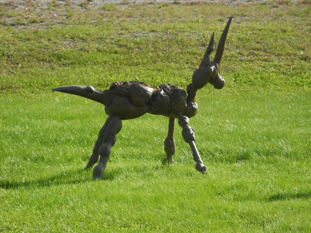
Creatures cleverly fashioned out of the burled wood found in the area adorn the front lawn of the Knotty Shop.
*-*-*
|
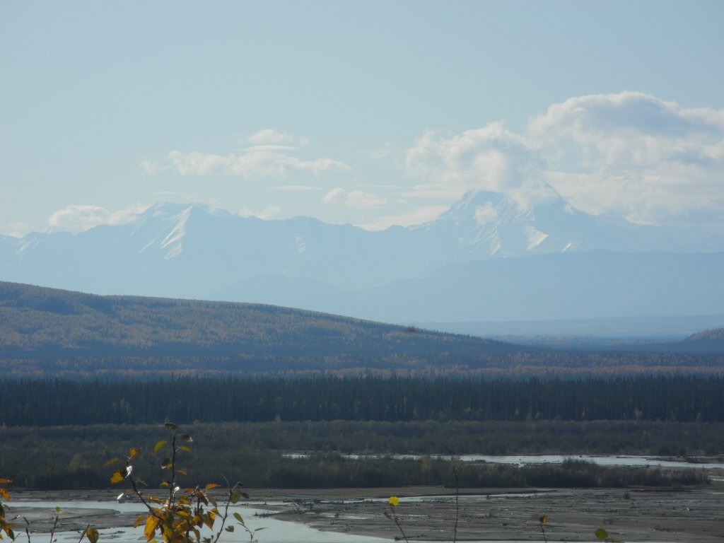
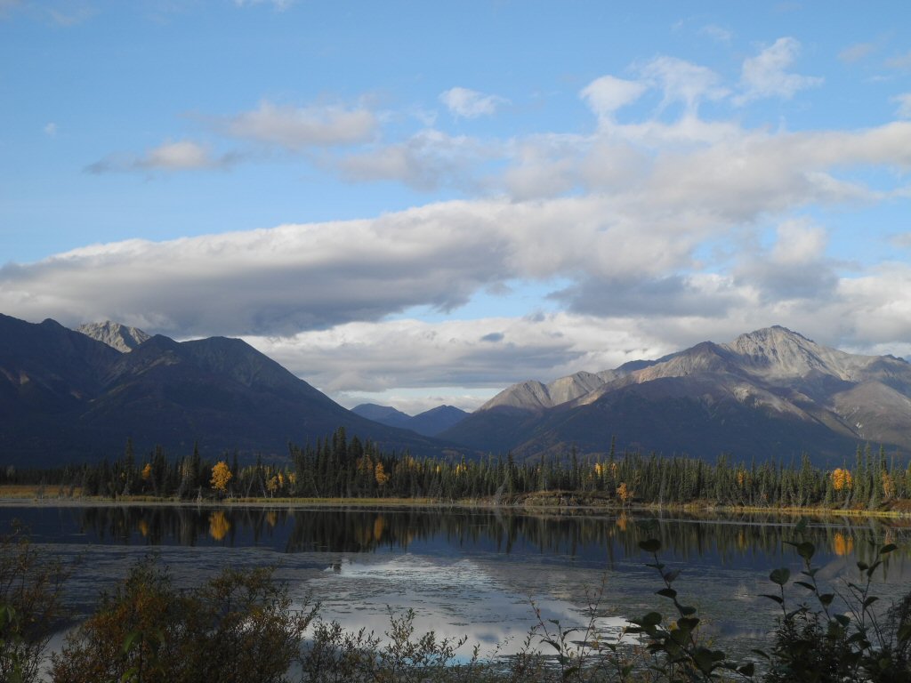
The Alaska mountains to the south are spectacular and the glacier-fed Tanana River runs right next to the road most of the time.
*-*-*
|
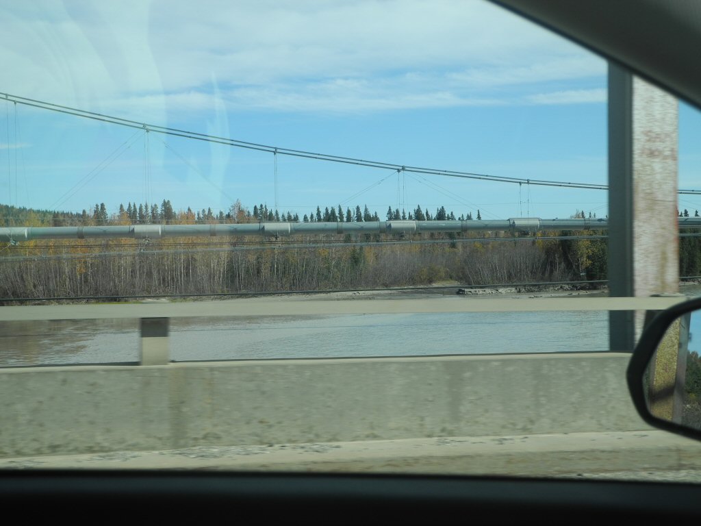
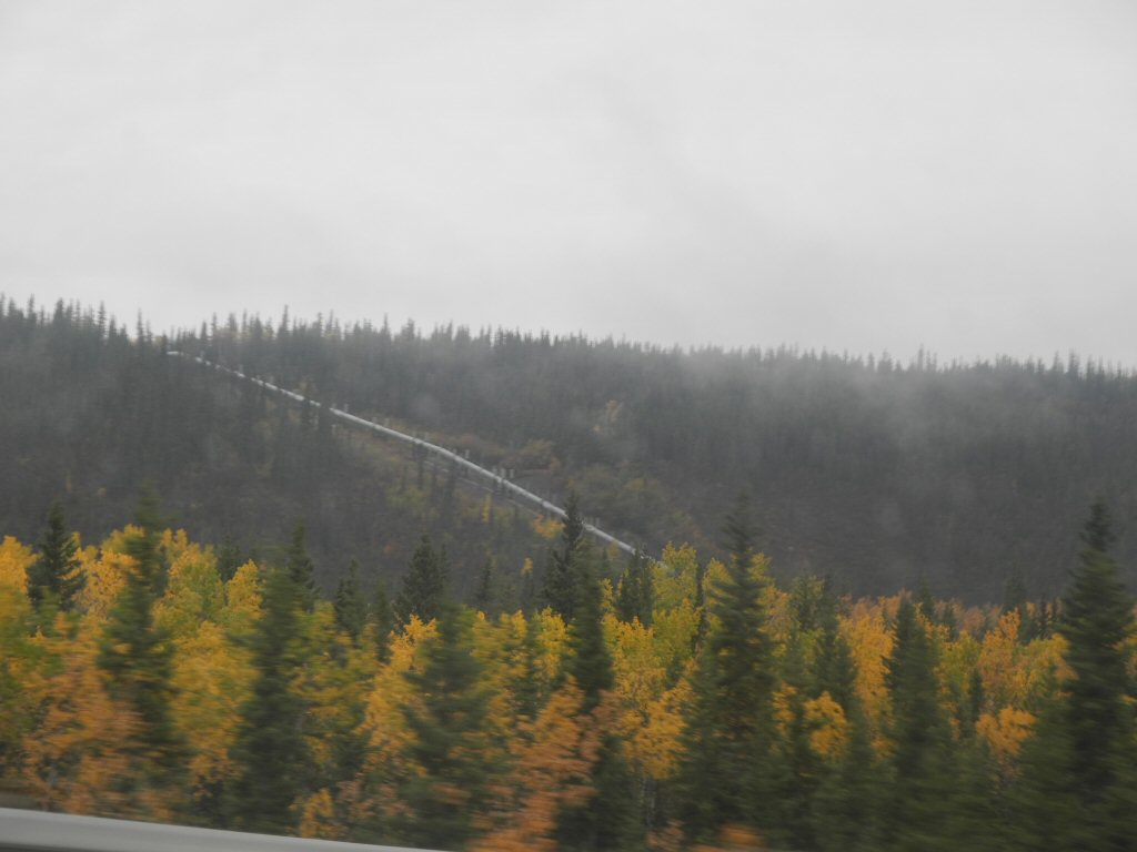
We also saw the Tanana River Alaska pipeline bridge near Delta Junction. The pipeline is unobtrusive most of the time, but comes close to the road occasionally. Here you can see it paralleling the car road on its own bridge.
*-*-*
We had lunch in Delta Junction. Originally we had the GPS take us to Bella Pizza, but it had a big sign that said closed until further notice, so we spied the Buffalo Center Drive-In across the street. There were a number of cars in the parking lot and it got pretty good reviews so we crossed the road. As we pulled up a man who had been sitting outside got up and walked over to our car. He told us they were closed for the season, as was most everyone. He suggested the IGA (grocery store deli) so we headed there.
After a bathroom break in the loading dock area (in an amazingly clean bathroom!), we got some fried chicken, mashed potatoes and Diet Coke, paid and headed outside to the picnic table to eat as we watched the citizens of Delta Junction do their grocery shopping. The food wasnt bad and we had ice cream for dessert. It was definitely a lunch to remember! We were off the beaten path now.
|
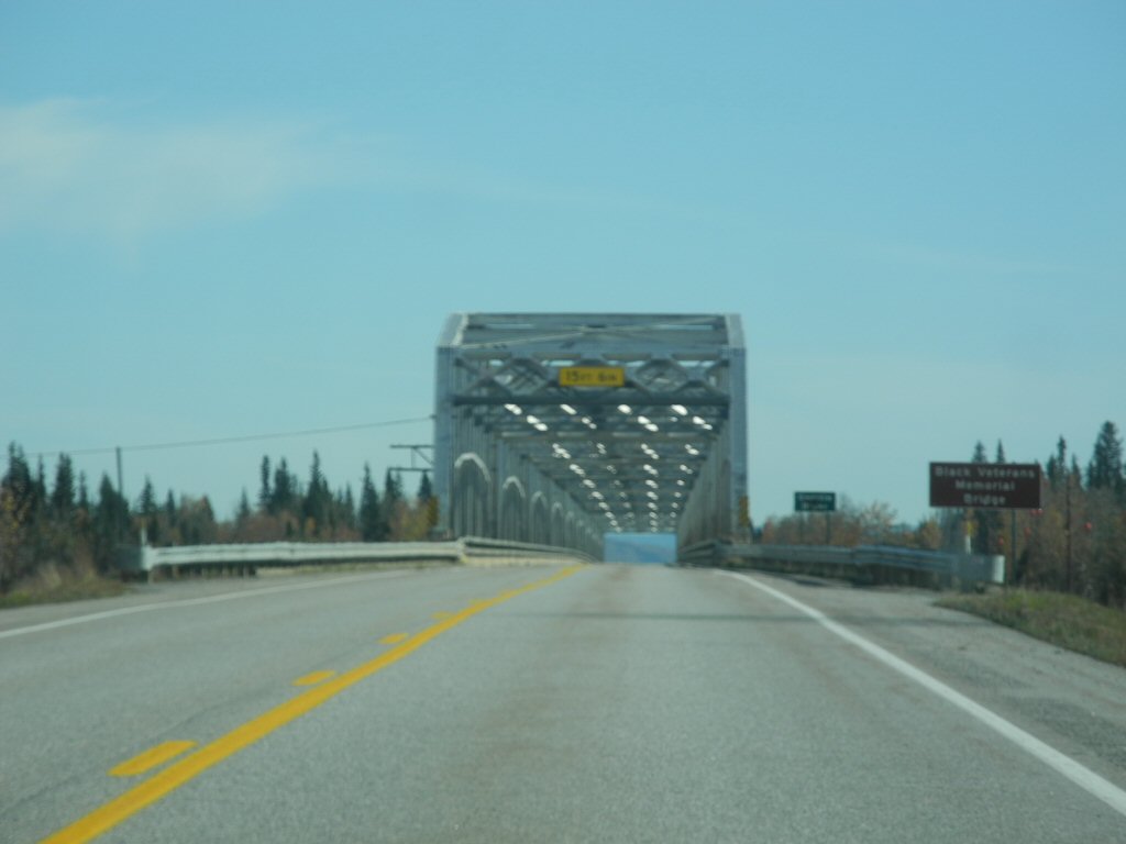
We left and had about 100 miles to Tok. We came to an interesting iron trestle bridge built in 1944 across the glacier fed Gerstle River. This was built during the construction of the Alaska Highway. It was rededicated as the Black Veterens Memorial Bridge in 1993 to commemorate the black soldiers who worked on the construction of the "Alcan" highway.
*-*-*
|
A view of the Gerstle Glacier in the Alaska Range. It supplies meltwater to the Gerstle River.
*-*-*
|
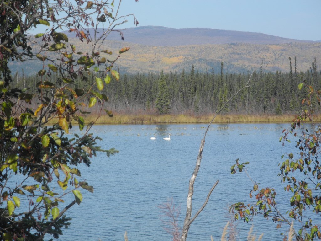
We stopped at Dot Lake to change drivers and saw a pair of trumpeter swans swimming around. There was also a Gray Jay who flew up to see what we were up to.
*-*-*
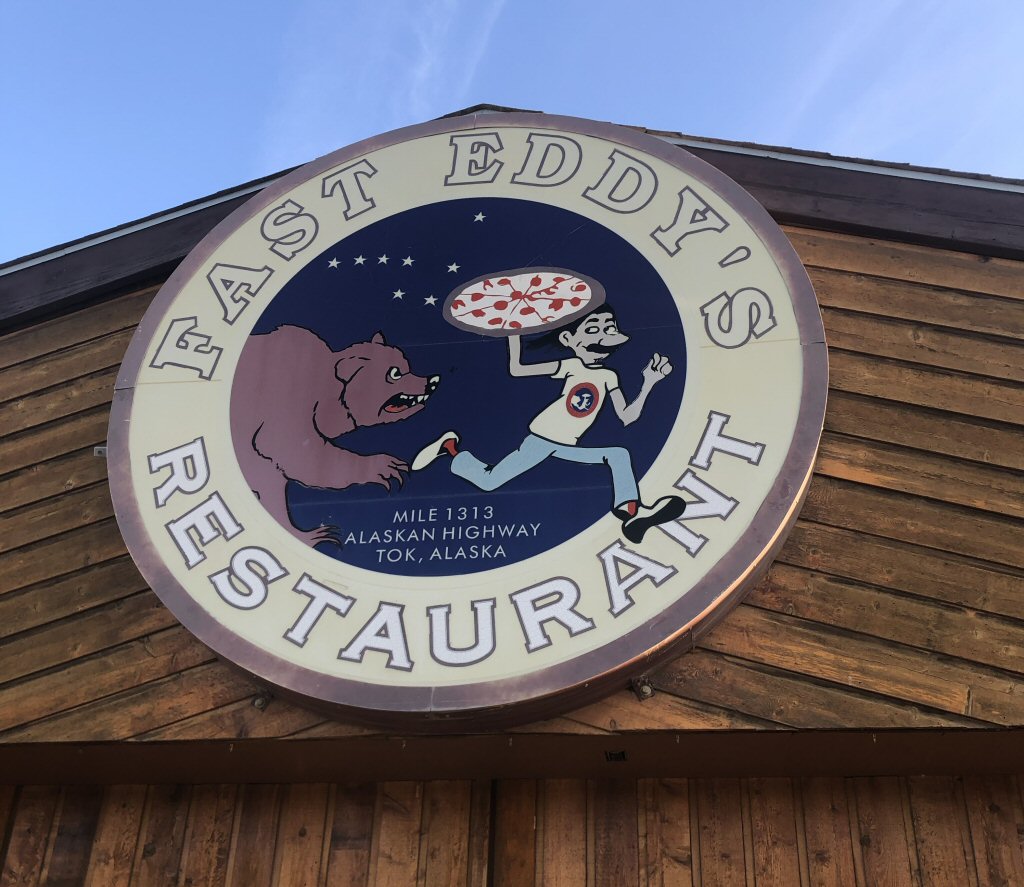
In this part of Alaska we ran into thick swarms of small flies. They were hitting the windshield so frequently it sounded like you were driving in a rain storm. The windshield was a mess when we finally arrived in Tok (rhymes with smoke), a small cross roads community with a large number of mom and pop motels and RV parks and one restaurant - Fast Eddies. We had pizza for dinner at Fast Eddies which was terrific and we even saved part to eat later.
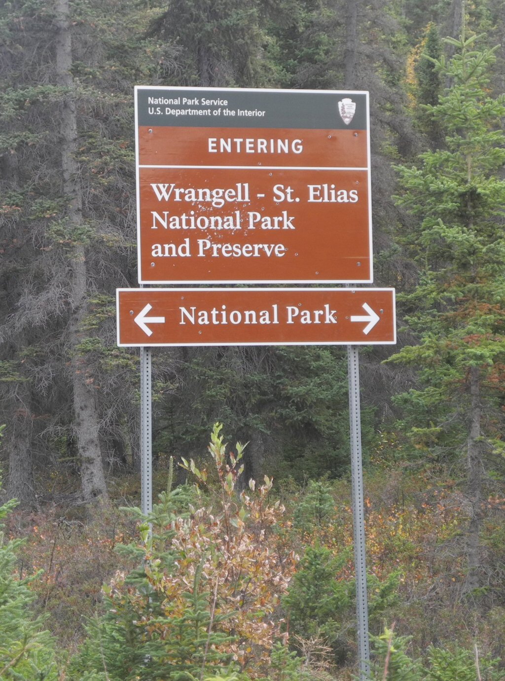
Tuesday September 10 Tok to Chitina and Wrangle St Elias:
We got up early, had breakfast at Fast Eddies and got on the road to Chitina. We wanted to get there early enough to get a chance to drive into Wrangell St Elias National Park.
|
The best (and only) place to eat in Tok, AK. We loved the logo!
*-*-*
|
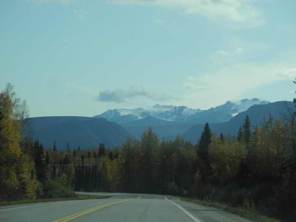
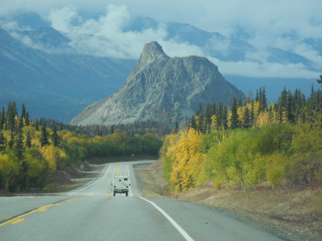
The drive down was nice and, again, very scenic. In the morning we had the Alaska Mountains to our left and the Wrangell Mountains on our right. Both were close but across an open expanse that was colorful and often had river views on one side or another.
*-*-*
|
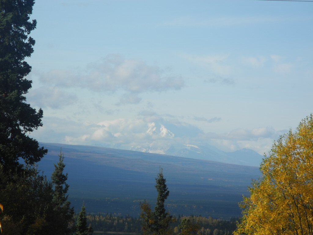
Our first view of the taller Wrangell Mountains on the left side and they were spectacular in the distance. We began to get really excited about getting to see this national park. It has the highest concentration of mountains over 16000 feet on the continent. It also covers over 22 million acres of land. We will only see a tiny portion as most is inaccessible except by plane or hiking.
*-*-*
|
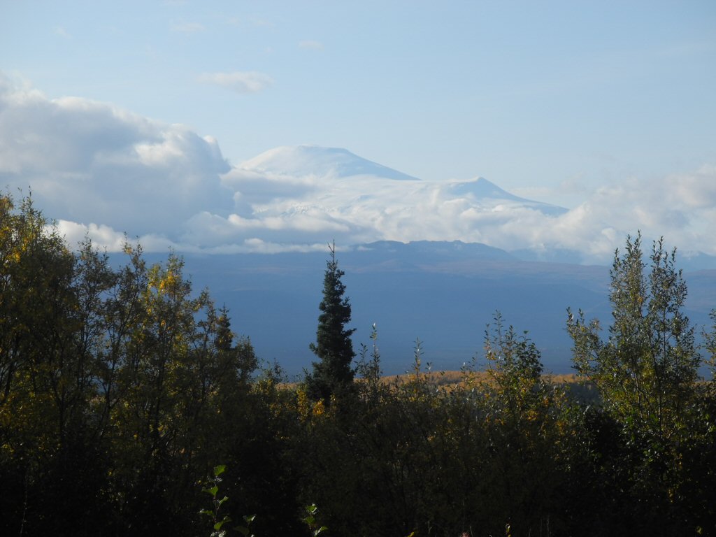
Here is Mt Sanford, at 16,237 feet one of the highest peaks in Wrangell-St. Elias Park.
*-*-*
We had planned to eat lunch in Glenallen, but it was a less substantial town than we expected and most restaurants were closed for the season. The one that was open didnt get very good reviews so we decided to eat our leftover cold Fast Eddies' pizza and peanut butter crackers.
We found a secluded rest area just south of Glenallen and pulled in to dine. We watched a woodpecker and a ground squirrel playing while we ate. It was a good way to relax.
|
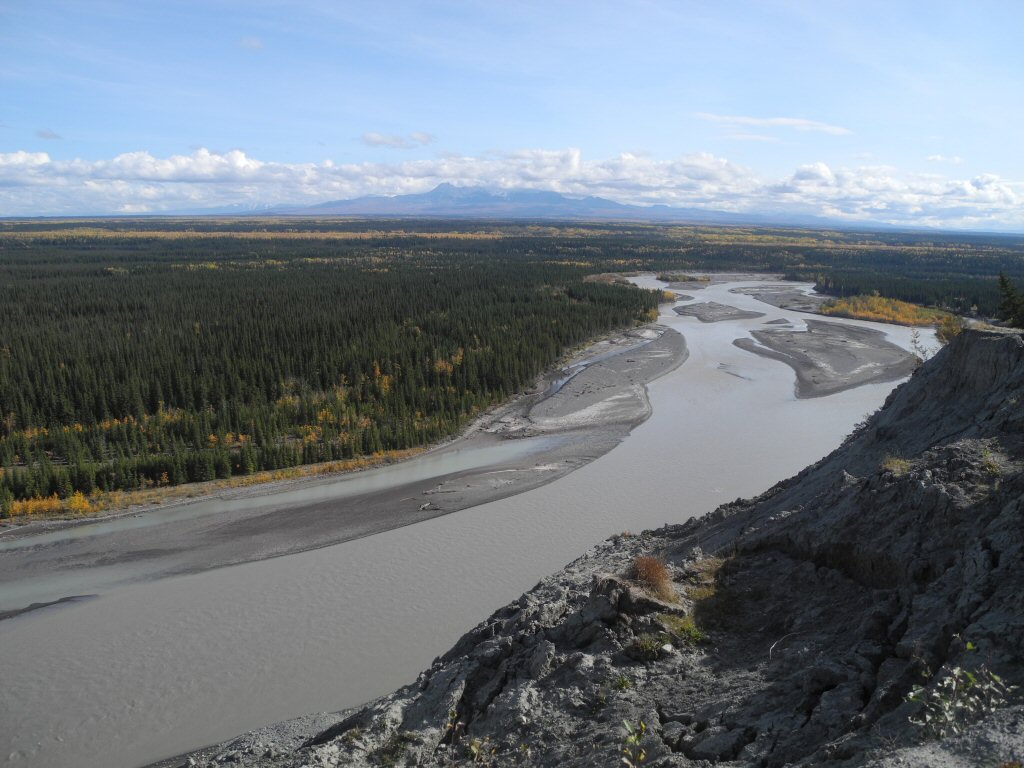
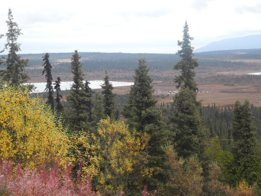
After lunch we walked down to a scenic overlook of the Copper River and got a few photos. Again the subdued colors of beiges, browns, greens, yellows and reds made for a lovely view. The Wrangell Mountains are in the distance.
*-*-*
|
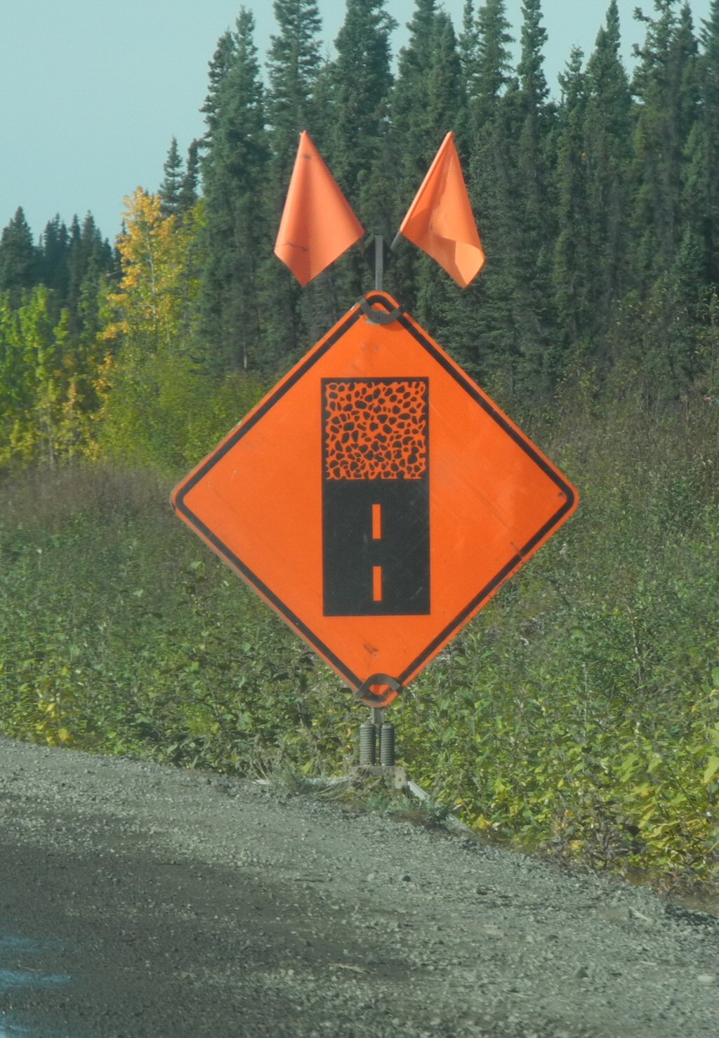
This road was very rough and we ran across several areas of road repair construction including one 12 mile stretch where we had to follow a pilot car. There were also multiple stretches where the pavement was abruptly replaced by gravel for several car lengths or more. This sign announces the transition from paved to unpaved road.
*-*-*
|
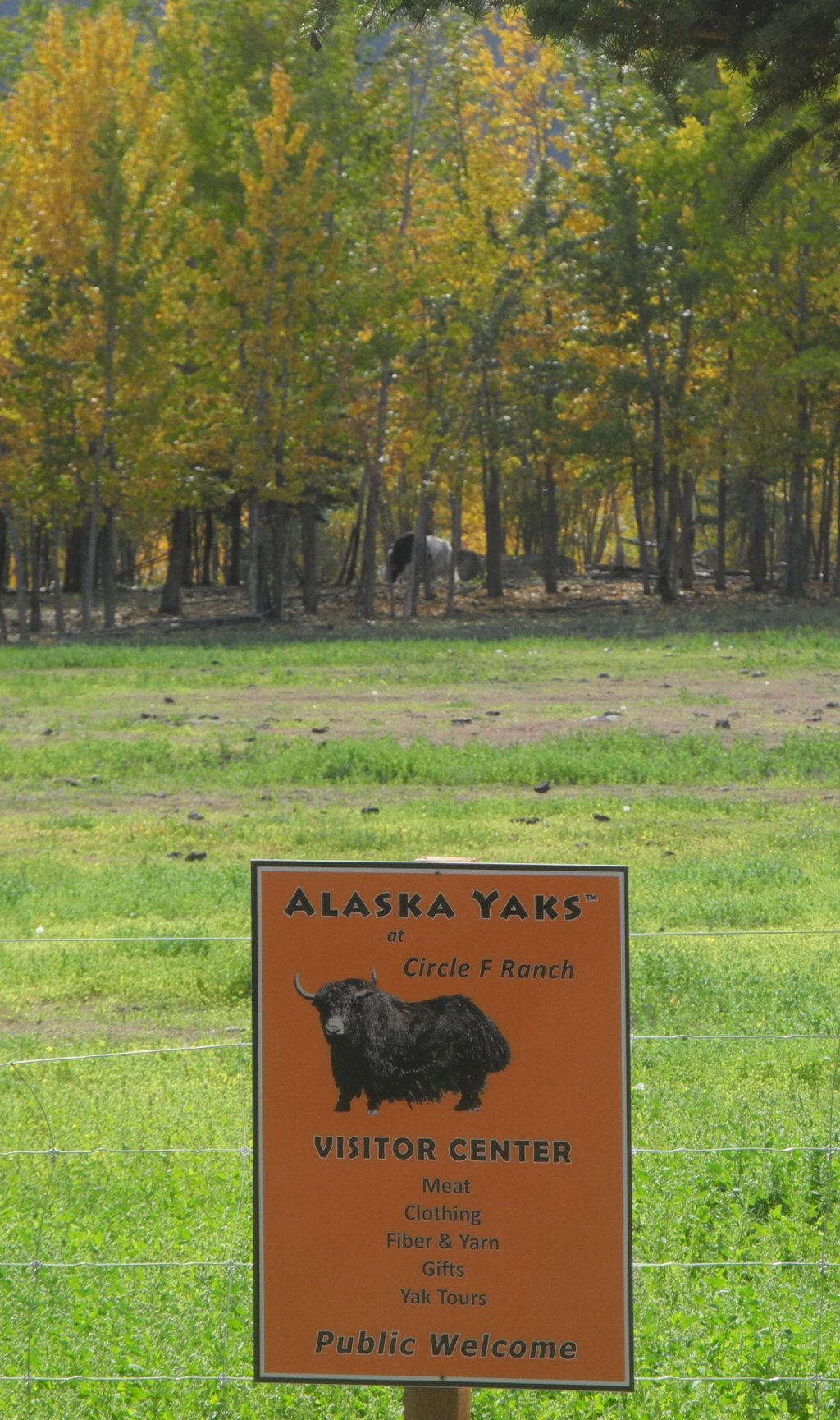
We took the Edgarton Highway-McCarthy road for the last 30 or so miles into Chitina (pronounced Chit-na). It was a smaller road lined with a tunnel of trees with private farms on both sides. One farm had a herd of Alaskan yaks. We tried to get a photo but they were shyly hiding some distance off the road in the trees.
*-*-*
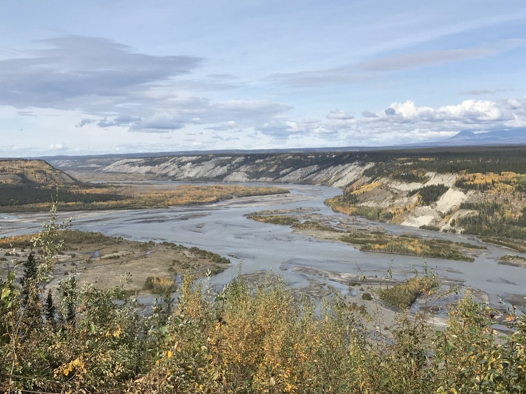
|
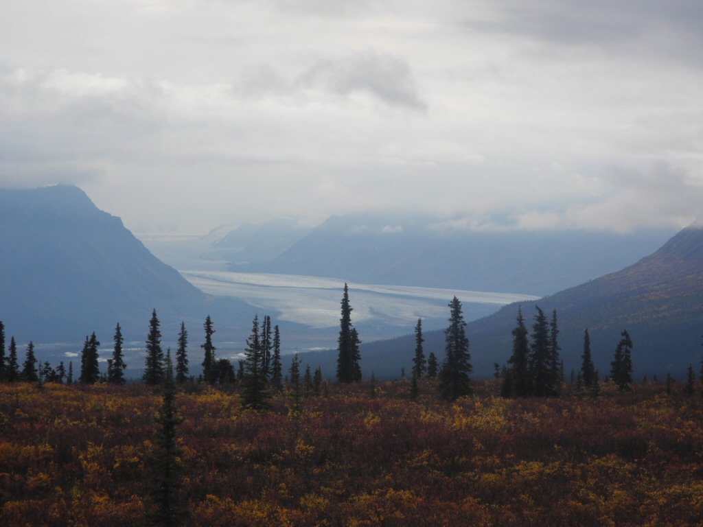
A little further on the vista opened up as we arrived at the Copper River valley. This is the best photo Barry took on the whole trip. The lighting was perfect and he managed to capture the sublime colors which were breathtaking.
*-*-*
|
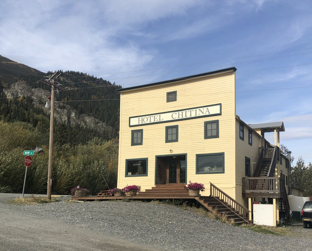
The road climbed again and got narrower and less maintained. We arrived in the tiny hamlet of Chitina and our hotel on Main Street. It looked closed and we knew from out conversation with Susan, the proprietress, that they had closed on Labor Day. But she had assured us we could stay there.
We tried the front door to the restaurant and it was unlocked. As we walked in Susan came from the back and met us. She was a sweet lady and provided us a room key. She asked what time we wanted dinner. We were the only guests and since the restaurant was also closed for the season, dinner would be prepared only for us. We agreed on 6 P.M. and headed upstairs.
*-*-*
|
After a short nap we headed for Wrangell-St Elias National Park on the McCarthy road. We only had about two hours so we decided to go as far as we could and turn back after an hour.
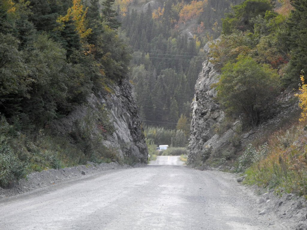
The road first passes through a one lane cut in the rocks just wider than the car. This picture was taken as we were leaving (rather than entering).
The road itself is an old railroad bed which is alternately paved, chip sealed or gravel. There is a sign that warns drivers to look out for lingering railroad spikes that might puncture tires. Yikes!
*-*-*
The railroad was started in 1907 and completed in 1911 to support the Kennicott Copper mine which operated until 1938. Indeed the mine is the reason the town of Chitina exists. At one time it was a booming place with 2 hotels, a dry goods store, a bakery and a mercantile. From Main Street there is a view of a small pond which has an imposing bluff behind it. It is a very charming site. After the mine closed, so did the town, abandoned as a ghost town in 1958.
Susan said she bought the hulk of the hotel in 2001 and spent five years restoring it. They had to start by shoveling dirt and sand out of out the interior because all the windows were broken and the wind blew it in. They also had to pick up and physically move the hotel building several feet when the town surveyed for sidewalks and informed her the hotel was sitting on the right of way. Ironically, the only sidewalk that exists is the one right next to her hotel!
|
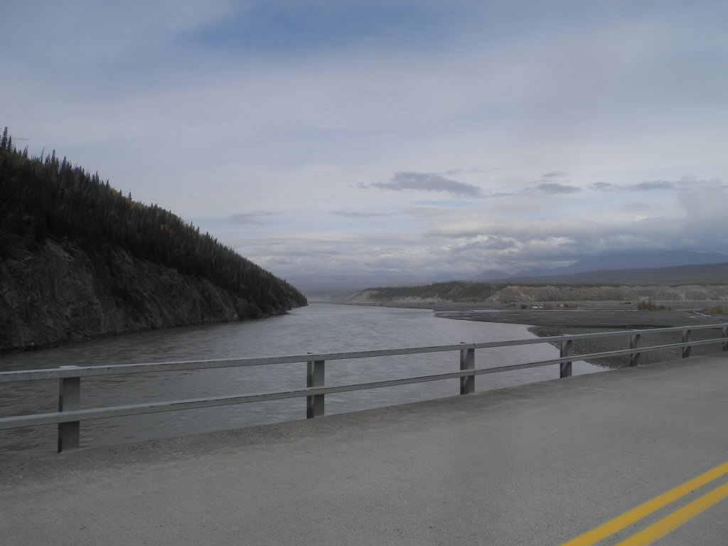
Shortly into the drive we cross a wide bridge over the glacier-fed Copper river. After the bridge the road turns to rough gravel with a steep drop off on one side down to the river and a hill with sedimentary rock in the making on the other side.
*-*-*
|
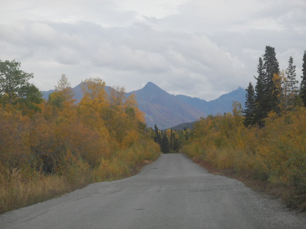
The drive is beautiful with gold trees, glimpses of ponds or rivers, and the ever present backdrop of mountains in the distance.
The road varies between chip sealed - almost like pavement where you can go 30 mph and gravel where the top speed is more like 10-15 mph. It is actually better than we had expected.
*-*-*
|
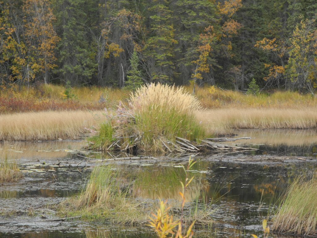
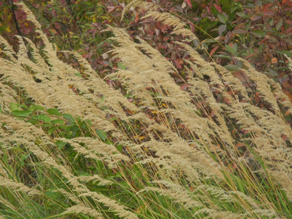
We pass numerous small ponds, always keeping an eye out for wildlife and are rewarded with the sight of two massive beaver lodges. Here the beaver lodge has native grasses growing from the top. We never saw any beaver though.
*-*-*
|
At mile marker 15.8 we officially enter the park.
*-*-*
|
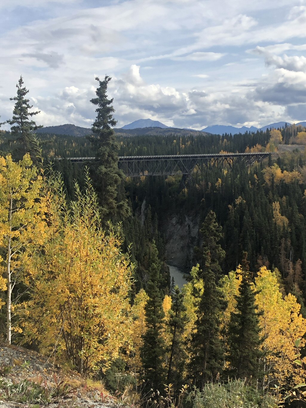
At mile marker 17.2 we come to the one lane steel trestle Kuskulana Bridge across the Copper river gorge. It is 775 ft long and 238 ft above the river and was built in 1910. It is a wonderful feat of engineering and we drive slowly across.
*-*-*
|
Unfortunately we have to turn around and head back out of the park at this point because it has taken us over an hour to get to the bridge. This is a gorgeous place and it would be a wonderful vacation to come back here and explore more.
*-*-*
|
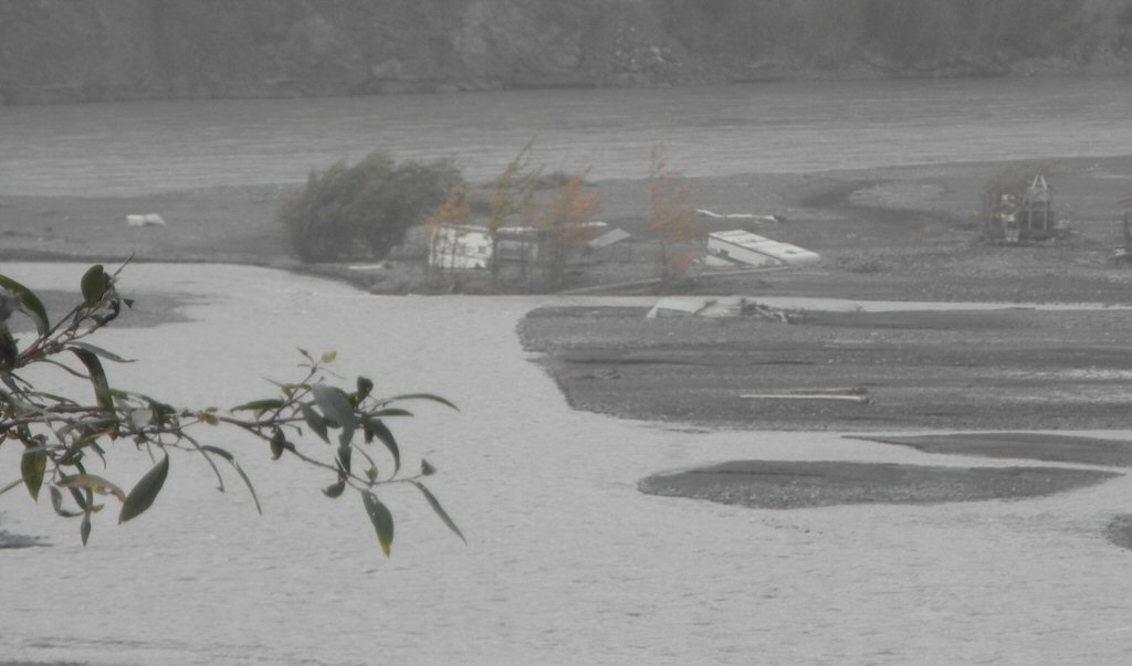
On our way out, Barry notices a travel trailer abandoned in the Copper River and then we notice another clump of multiple trailers sitting cockeyed in the same area. When we got back to the hotel, we asked Susan about it and she told us there was a fish camp, consisting of trailers, set up out on the gravel bar. The river was running pretty swiftly and it changed course and the trailers got caught up and swept away. This had happened several years ago.
*-*-*
After washing up we went down to dinner and were very pleasantly surprised. In addition to having the dining room to ourselves, Susan was an excellent cook. We had a lovely salad, grilled chicken, baked potatoes and broccoli. It was all very good. And then we had a chocolate brownie sundae. We were stuffed after such a fine meal!
We showed Susan our aurora pictures and she was taken by the one Barry captured with the Big Dipper. So we went out front and shared it with her staff who were having a somewhat raucous party celebrating the end of the season. Then Barry shared some of our astrophotos with them and they were really excited. They seemed like a fun, happy group of friends.
Wednesday September 11 Chitina to Anchorage: We were treated to another custom meal by Susan before we got on our way. We retraced our drive back to Glenallen, stopping to look for the yaks who were nowhere to be seen.
|
We did see one more leg of the Alaska pipeline just south of Glenallen running paralell with the road to the port city of Valdez, AK some 100 or so miles to the south. At Glenallen we turned west on Alaska 1, called the Glenn Highway along this leg.
*-*-*
|
The day started out drizzly and foggy but eventually mostly cleared to The day started out drizzly and foggy buteventually mostly cleared to
some low-lying clouds that obscured the mountain tops. Again very beautiful but different terrain than previous. All along the road we were treated with the Chugash mountains off to the south and large areas of permafrost with widely spaced trees and the beautiful purple-gold ground cover. This picture depicts what we have come to call the colors of Alaska.
*-*-*
|
We also started to see glaciers. All along this highway, to the south, are glacial views.
*-*-*
|
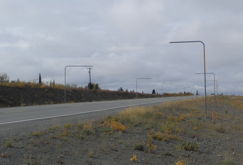
At overpasses and along some stretches of road we saw these posts sticking up and couldn't figure out what they were for. We read in our Alaska Milepost 2019 that these are to orient the snowplows in winter.
*-*-*
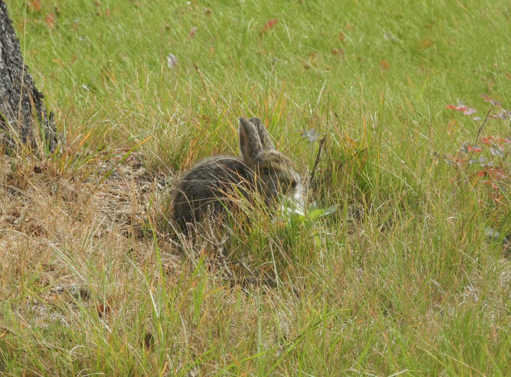
|
Susan had recommended the Sheepshead Lodge for lunch as it has good food and was about halfway. We found it and had a terrific lunch with huge, heated cookies for dessert. They were also pretty quick and we were soon back on the road. As we pulled out of the parking lot, we saw this adorable bunny sitting in the grass.
*-*-*
|
We found Lions Head Dome also called Glacier Point, a rather unusual rock formation, which occurred on a stretch of road that was very undulating. However in general the quality of this road was really good. In the background, obscured by clouds, is another glacier.
*-*-*
|
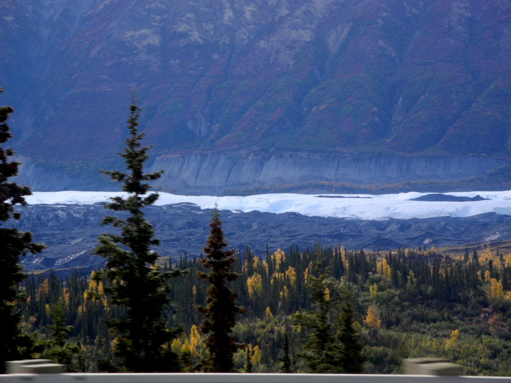
Here is another glacier, the Matanuska Glacier, which is a part of Glacier park and is very close to the highway
*-*-*
We soon arrived in Anchorage, ran the car through a car wash, filled with gas and checked into the Lakefront Anchorage Hotel.
Thursday September 12 Anchorage to Seattle to Atlanta After a miserable nights sleep, probably mostly due to excitement of going home, we got up at 3:15 A.M. to get ready and get to the airport for our 6 A.M. flight. After a brief layover in Seattle, we arrived back in Atlanta around 8:30 P.M. and drove home.
*-*-*-*-*
It was a wonderful trip, we got to see many breathtakingly beautiful landscapes and animals unique to Alaska. The people who live in this beautiful but harsh land are warm and friendly. They also work very hard to make a living, often with long days or multiple jobs.
We went at a beautiful time of year when the leaves were turning but the winters start in late September and dont end until May. Our original plan had us on a cruise two weeks later ending up in Anchorage to start our drive on September 17th. That would have been too late. The leaves would have all dropped, the colors more dull and some areas would have been completely closed and no longer accessible.
Alaska is a beautiful state with many amazing sights, but we realize we saw only the tiny fraction of the state accessible by the state highways. It is also a huge state and it would take weeks or months to even scratch the surface of all this state has to offer.
Temperatures in winter can be 40 to 60 degrees F below 0. At the winter solstice, December 21, there are typically only 5 hours of daylight in Fairbanks. Our hats are off to the people who call this land home, but they are of heartier stock and Barry and I agree we couldn't do it.
One other note, many restaurants, hotel rooms, and services are expensive relative to the lower 48. This is often referred to as Alaska pricing. Part of this is due to the fact that many businesses operate only 4-5 months a year - May to Labor Day. That is when they get all of their revenue. So if you go, be aware that it will be expensive to sleep and to eat. But there are surprises. A nice restuarant will not be significantly more expensive. Gas was not much higher and in some places was lower than Atlanta. Cab and Uber fares were cheaper than Chicago.
And, finally, upon reflection, if we were doing it all over knowing what we know now Barry and I feel we probably would have done the cruise portion but left Holland America's care after the ship docked and rented the car to drive ourselves to Denali. There is no avoiding the bus ride into Denali since the park only allows bus access but it would have been far more tolerable if it had occurred by itself and not after a long day in the bus getting up to Denali and followed by a long day on the train getting back to Anchorage.
Lest anyone think this is a criticism of Holland America's land cruise portion it is not. The accomodations were terrific, it was well organized and orchestrated and the tour guides were knowledgeable. The bottom line is the distances are large in Alaska and the Holland America folks are faced with moving a large number of people from point A to point B. They do it with efficiency and style. It just may not be for everyone.